Operational Manual (Wiki)
Detailed visual guide for all marine operations (with 71 Real Screenshots).
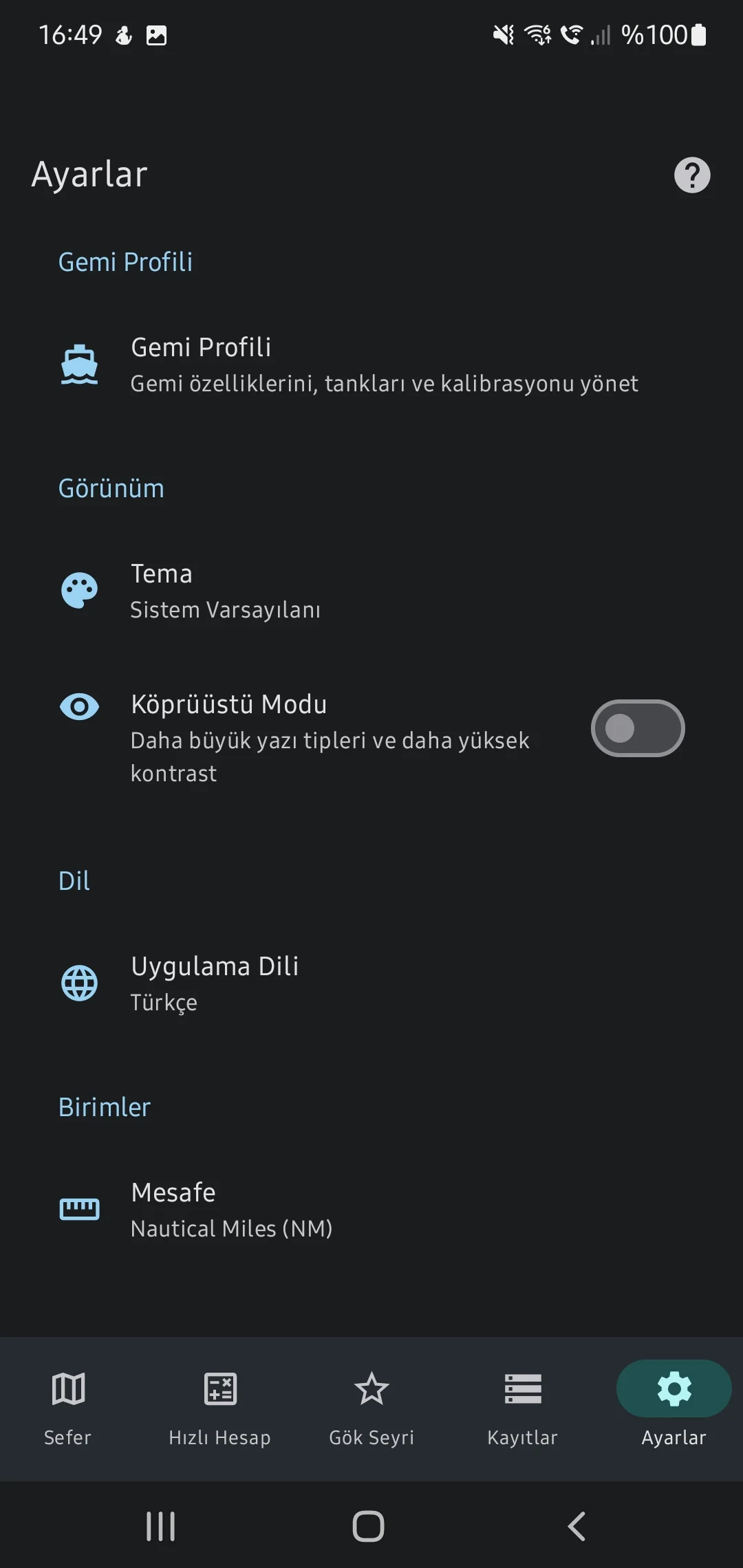
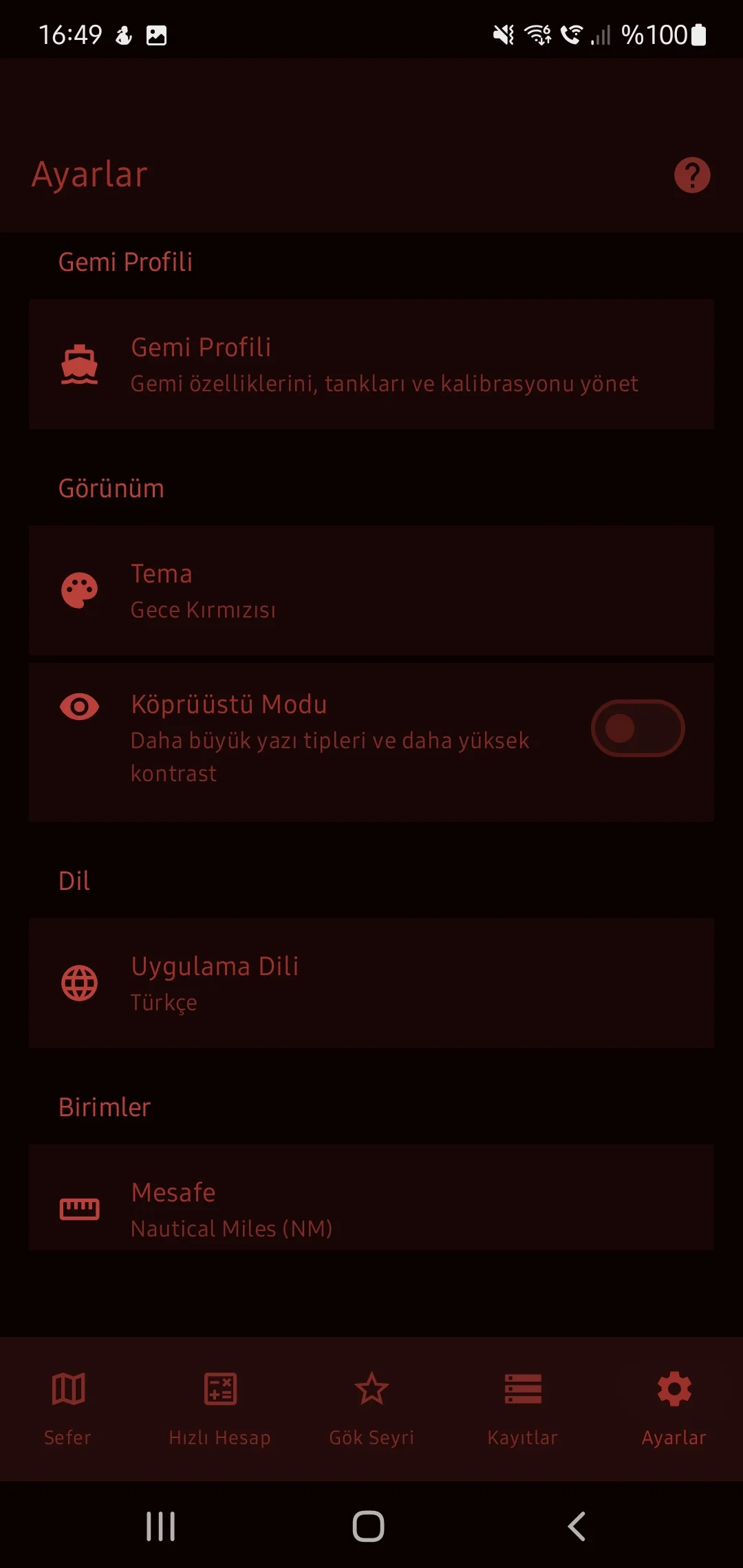
0. App Settings
Manage basic app behavior and night-vision themes for bridge operation.
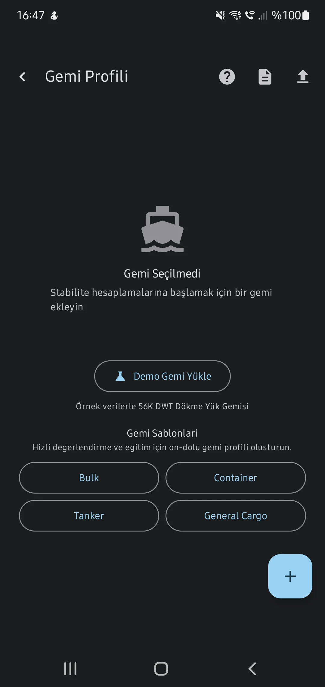
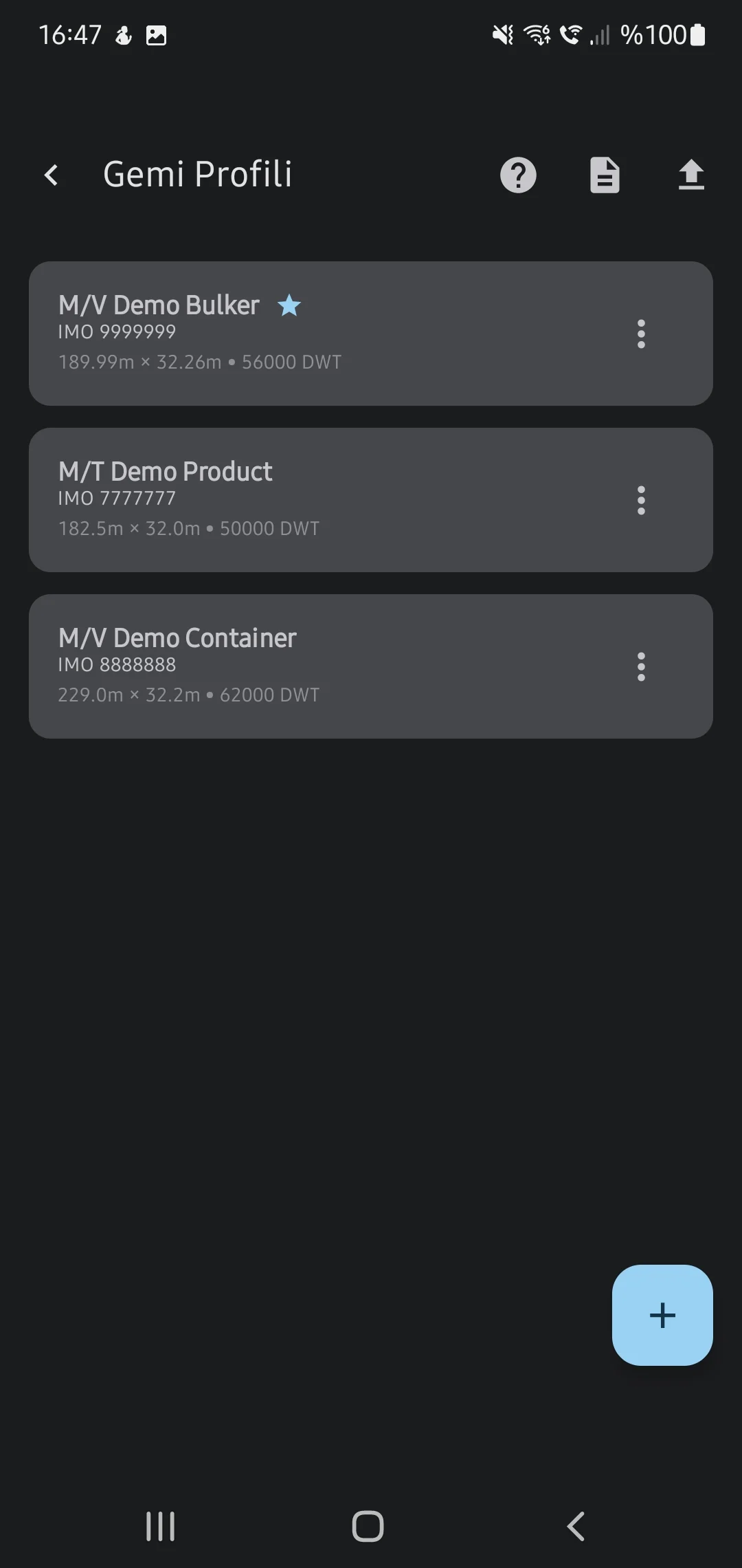
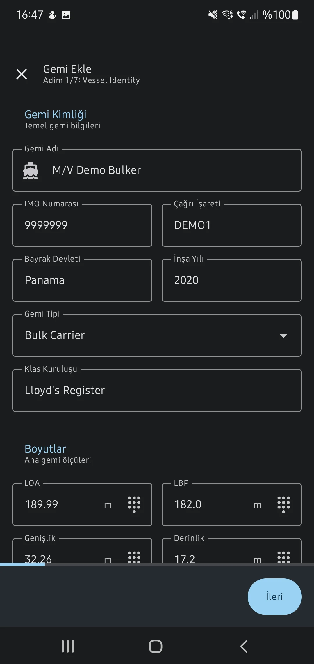
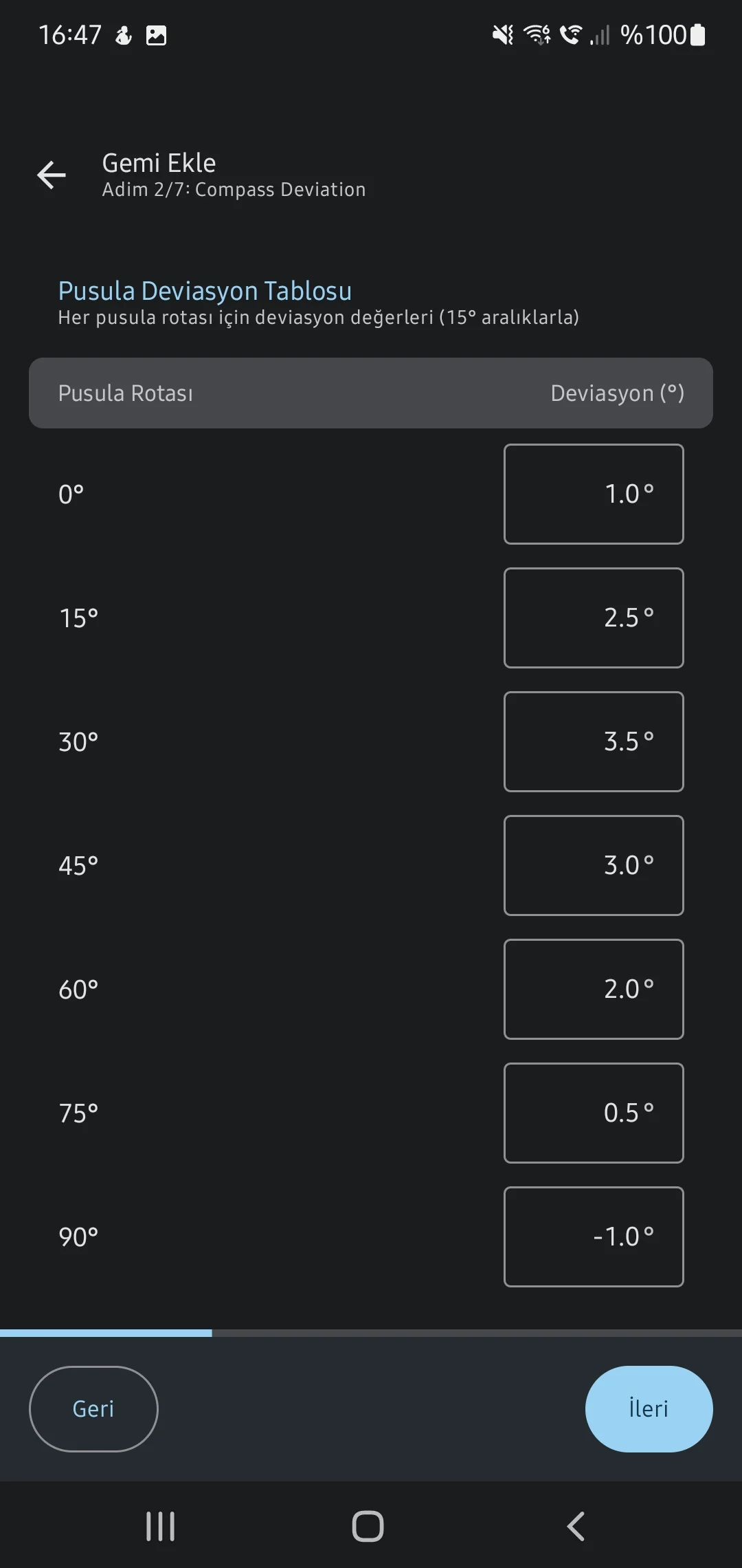
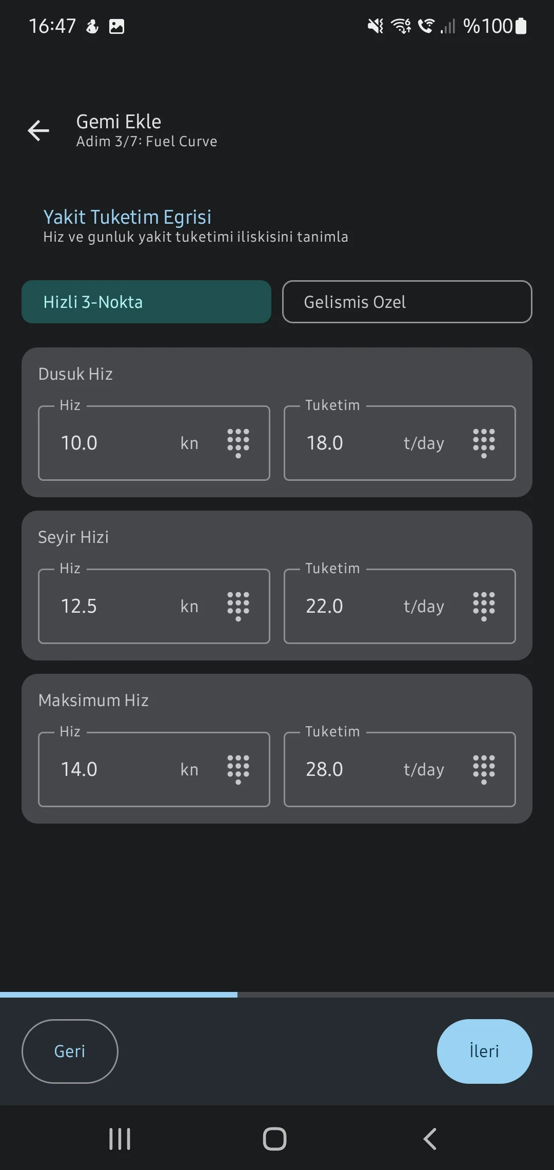
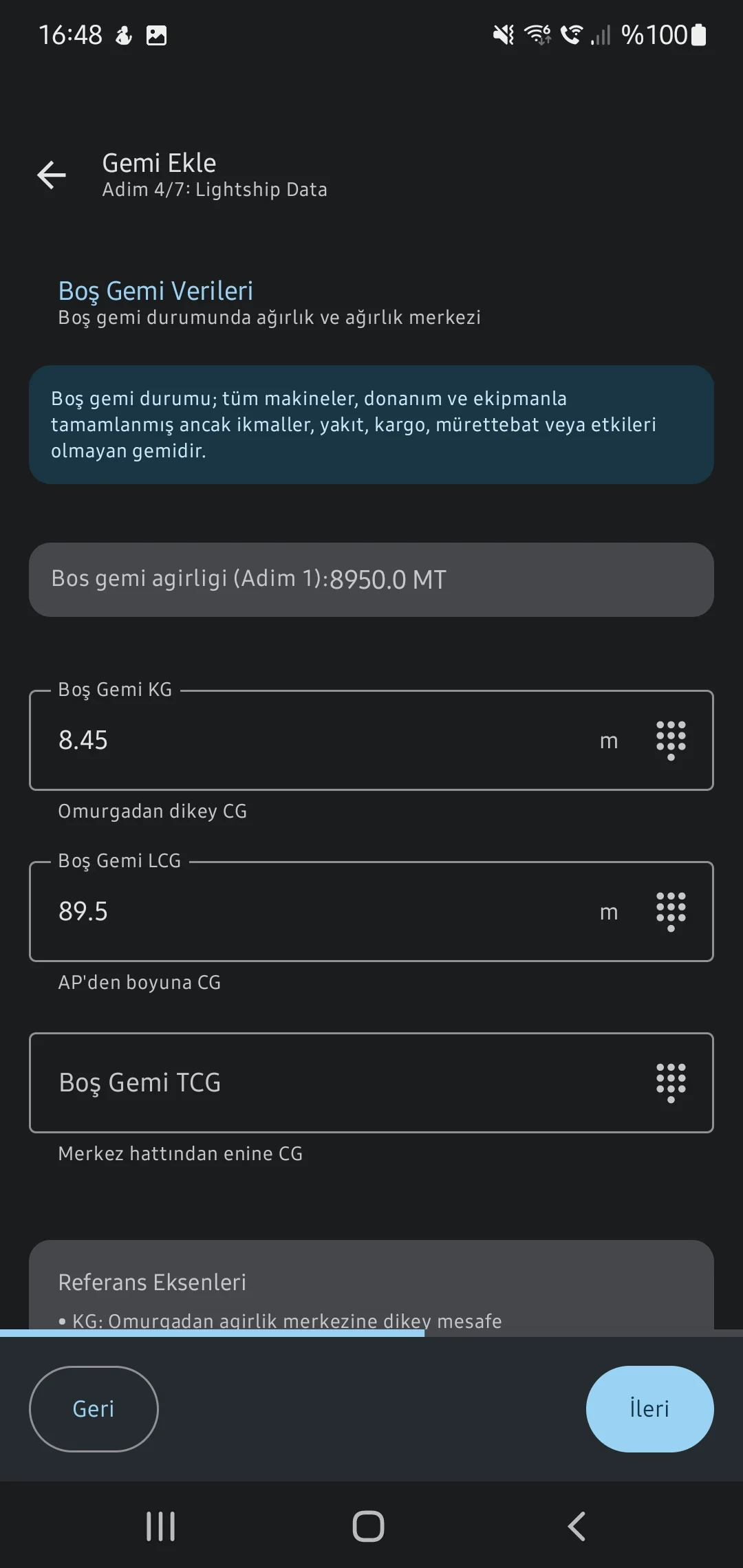
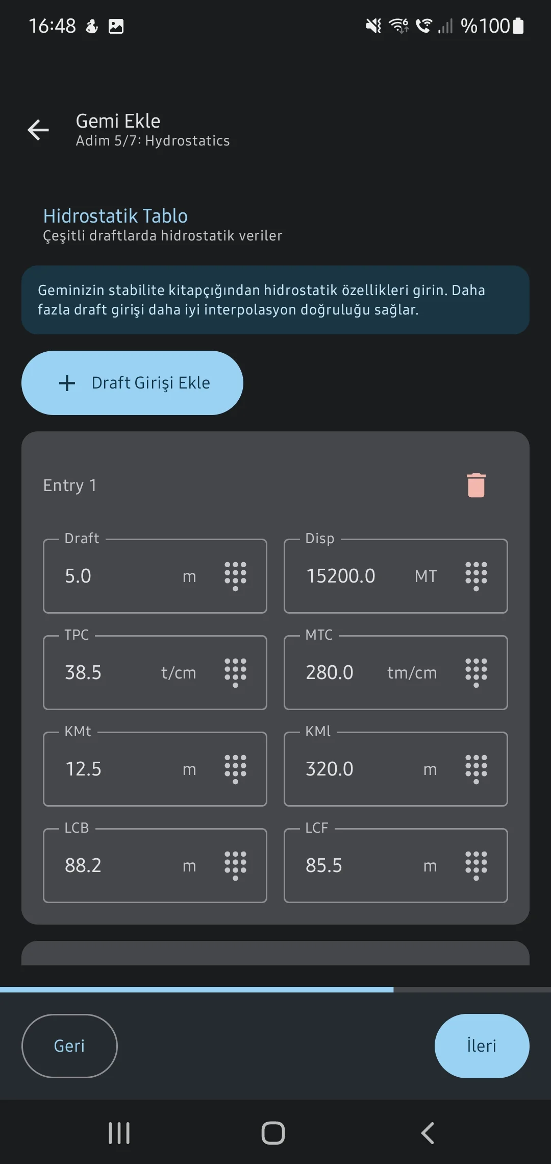
1. Vessel & Stability
Vessel Profiles & Hydrostatics
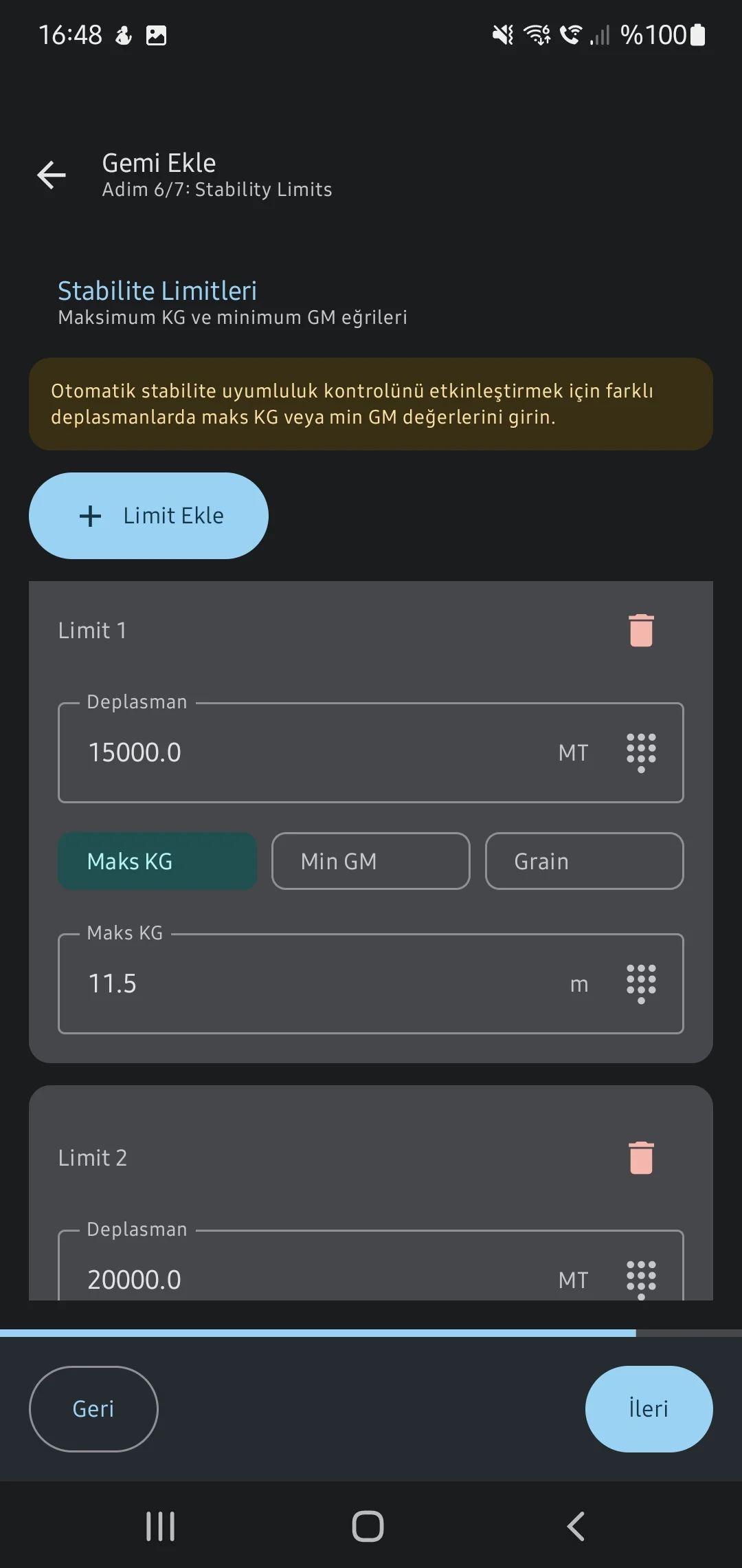
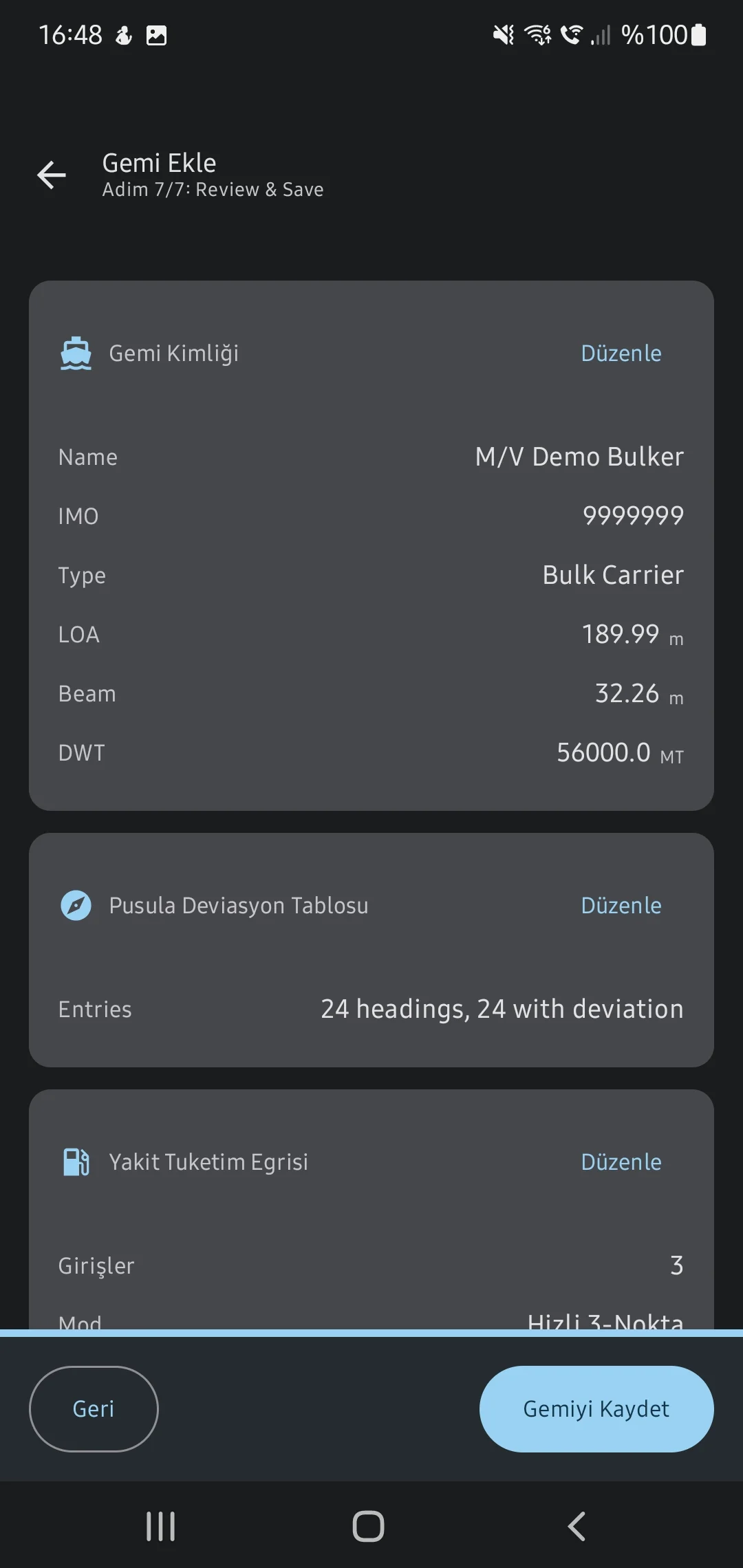
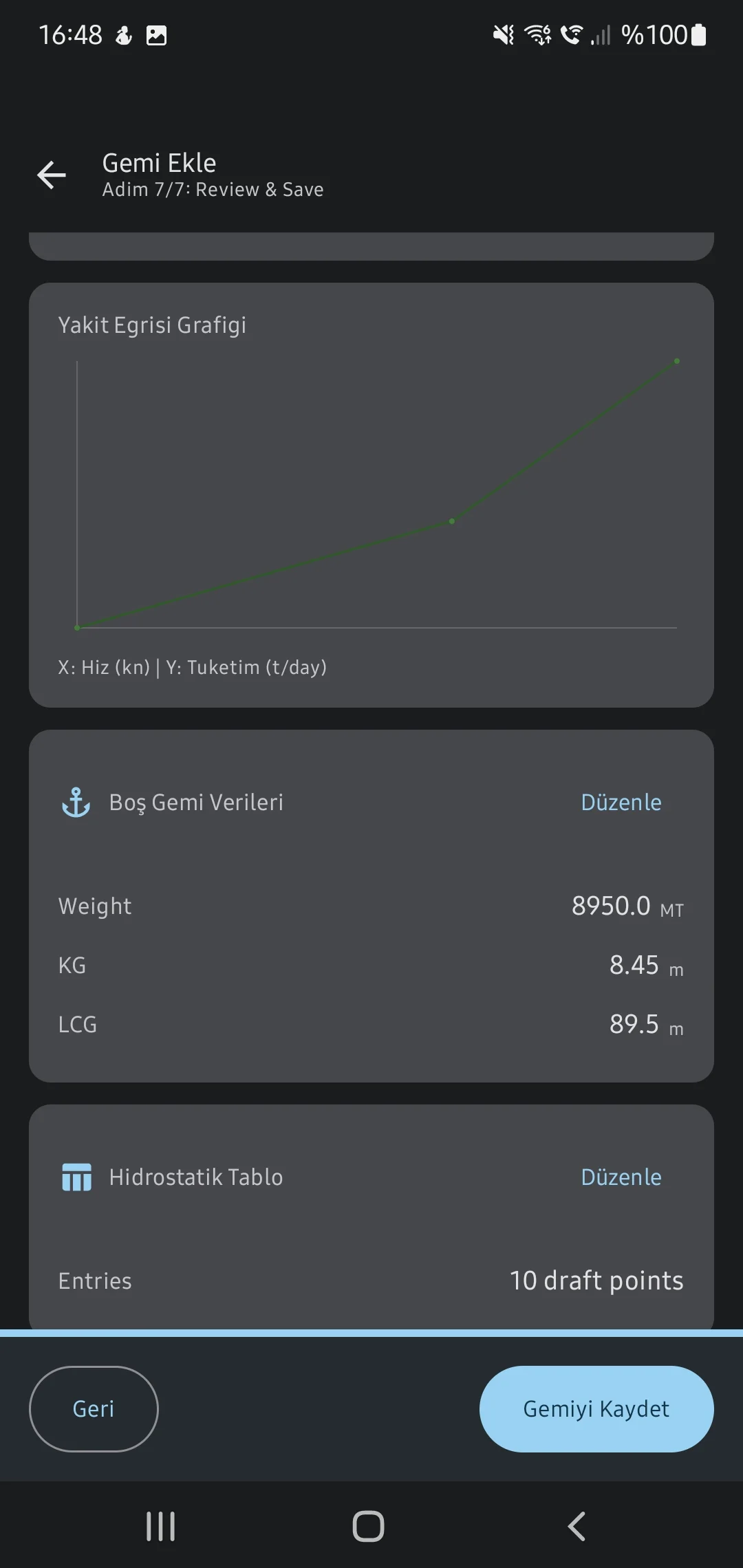
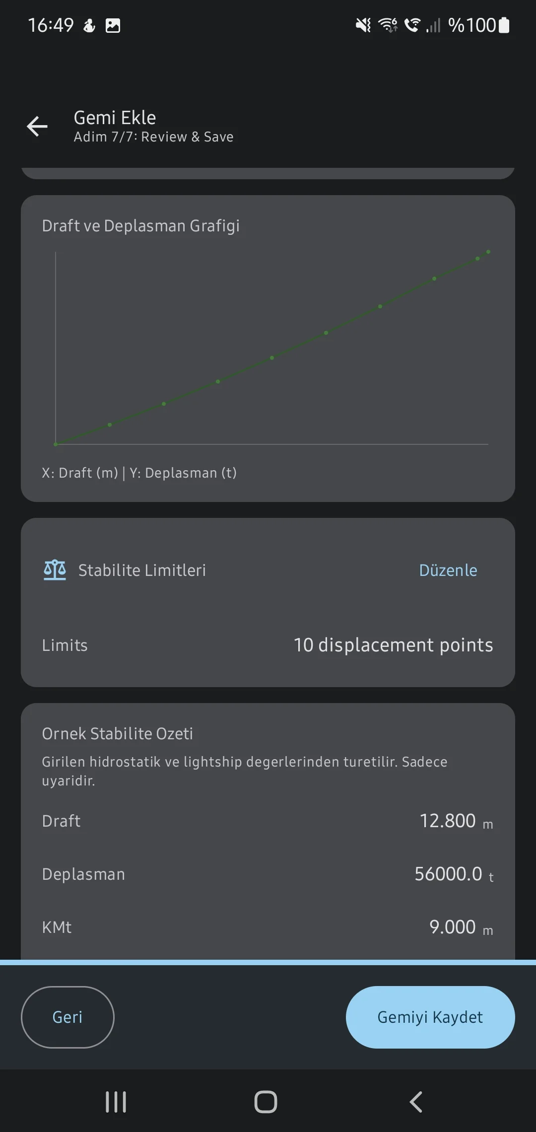
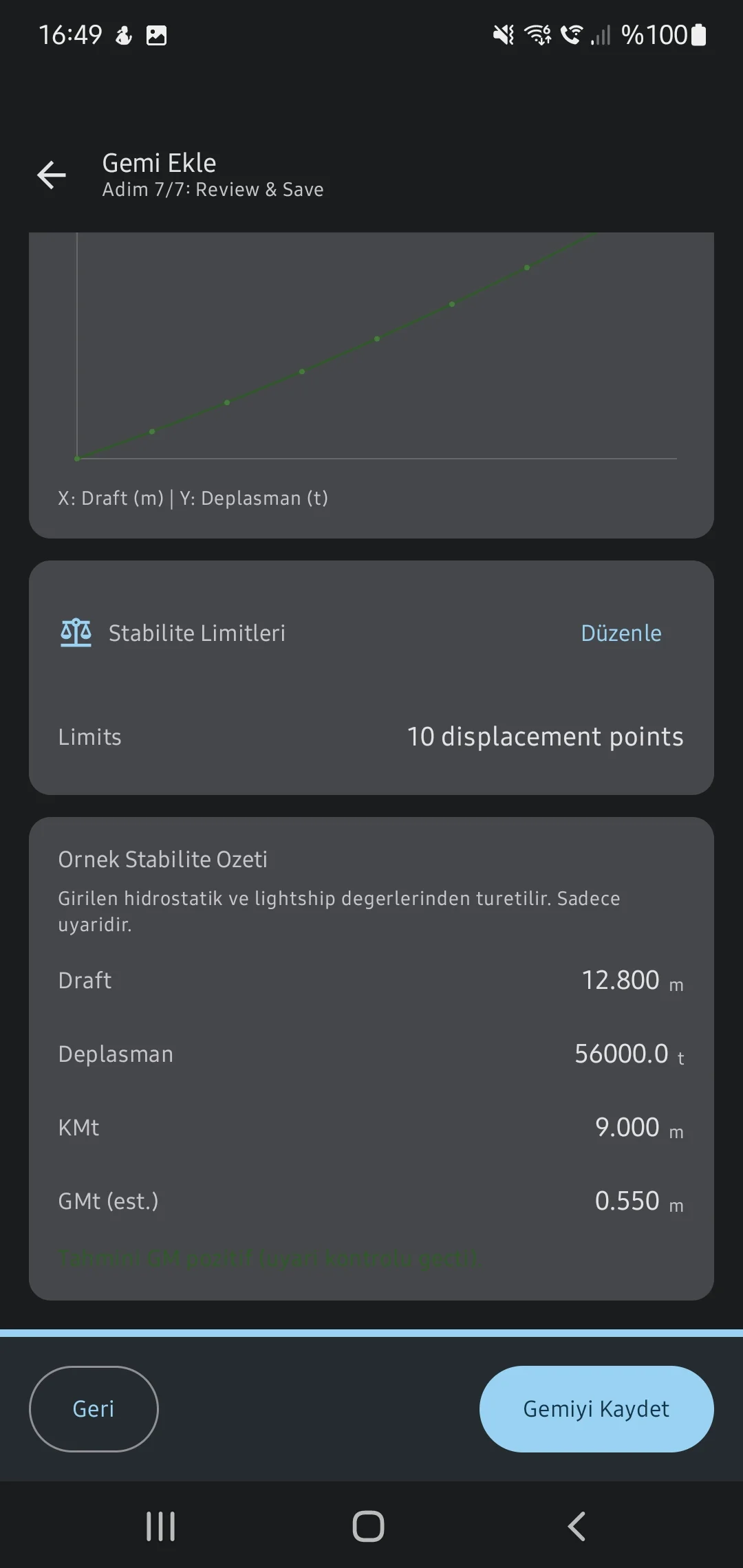
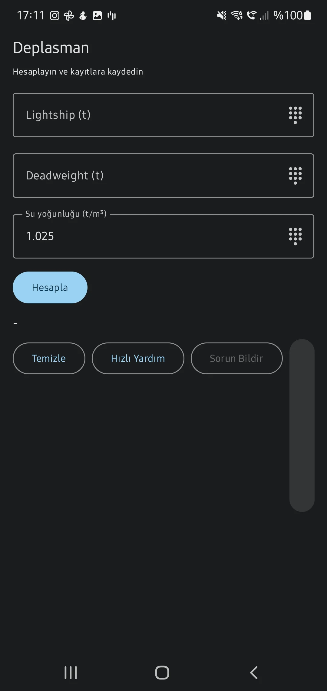
Begin by mapping the vessel's primary particulars, lightship constraints, fuel curves, compass deviation tables, and hydrostatic data (KN curves).
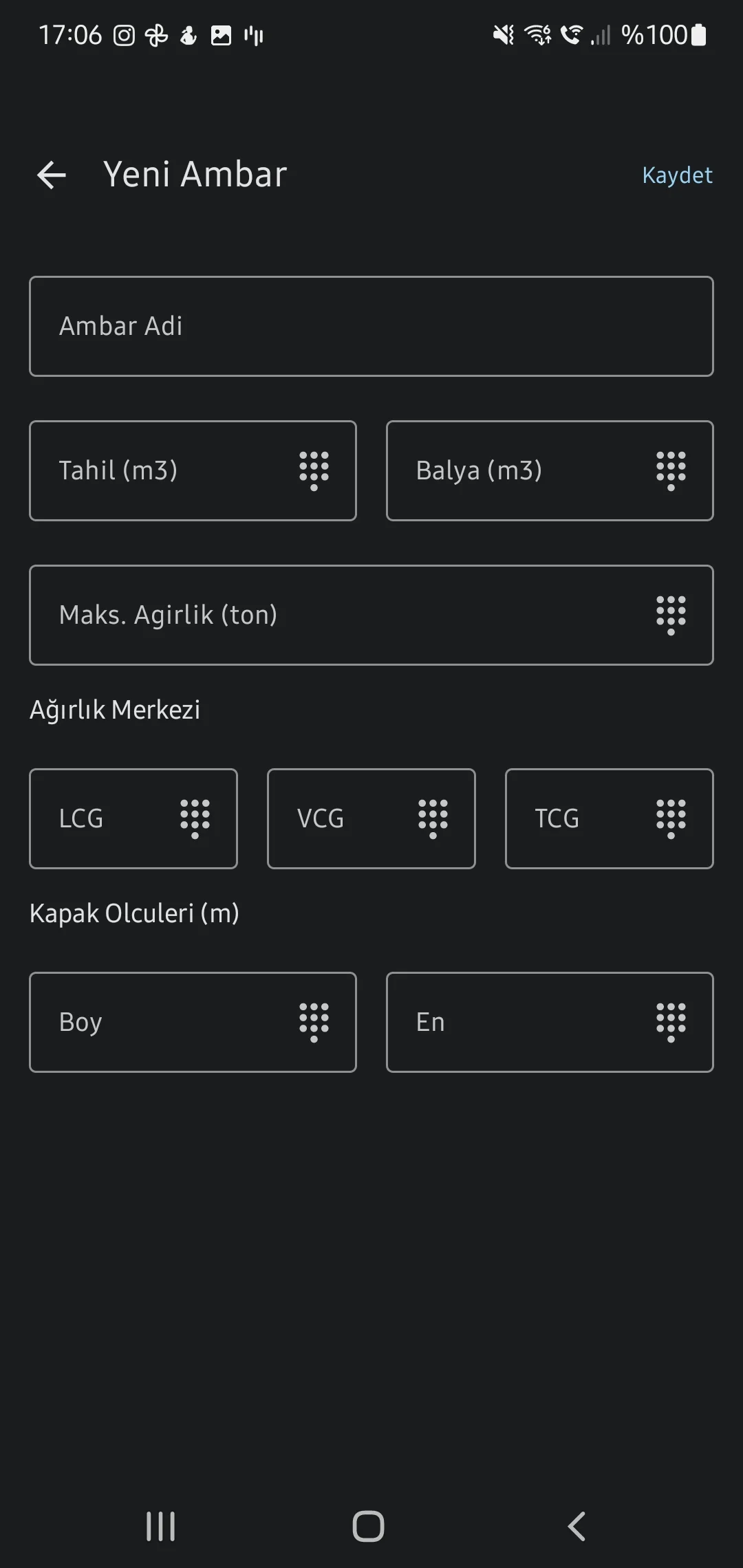
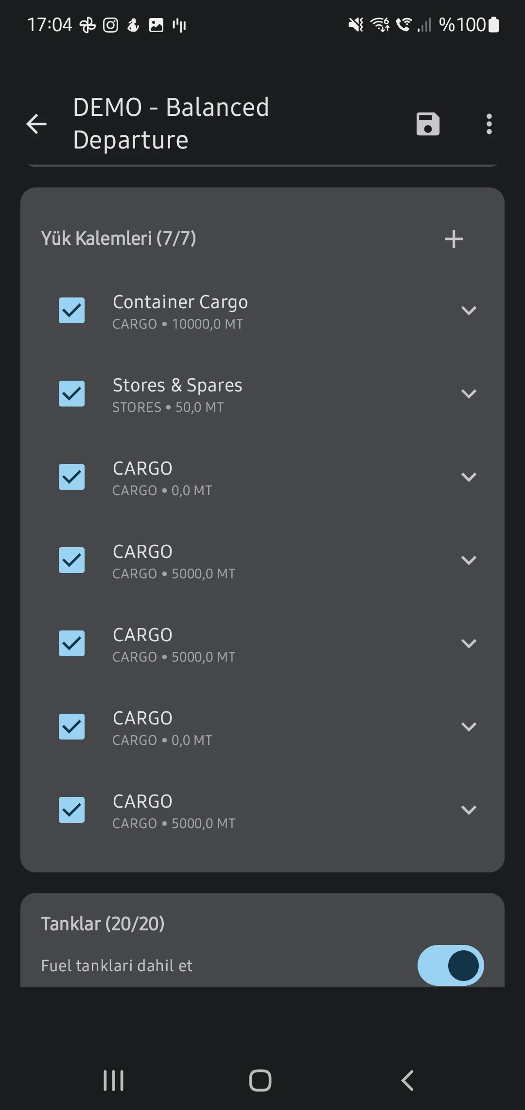
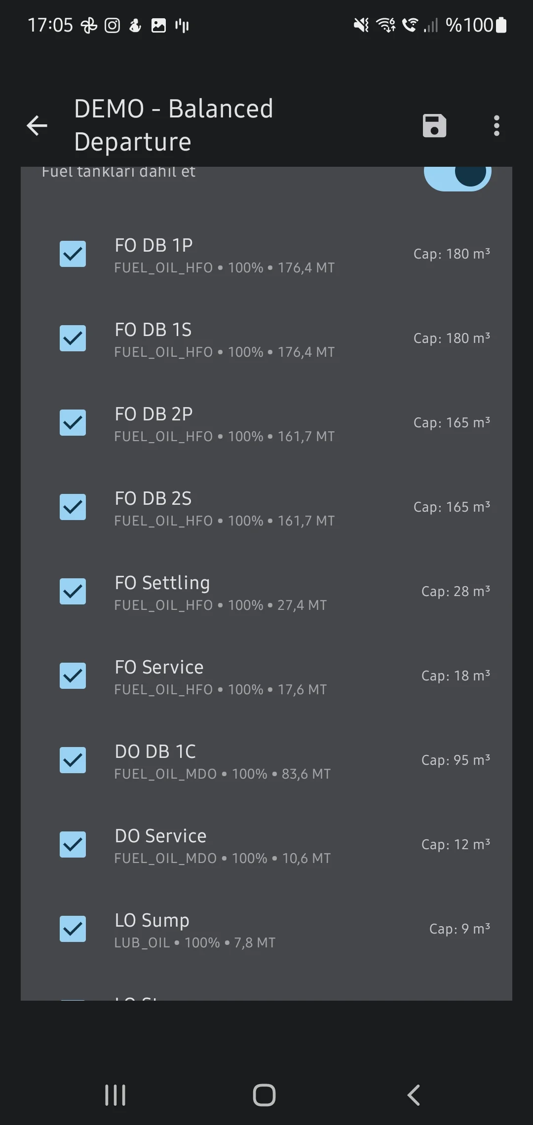
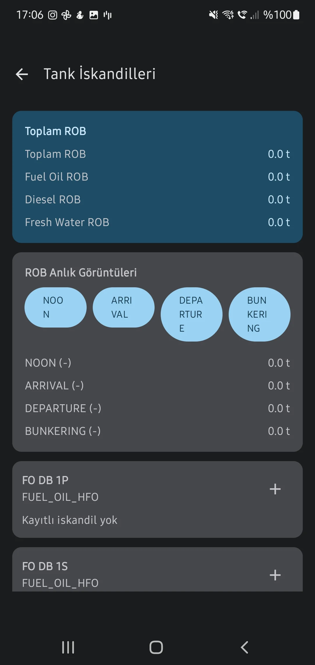
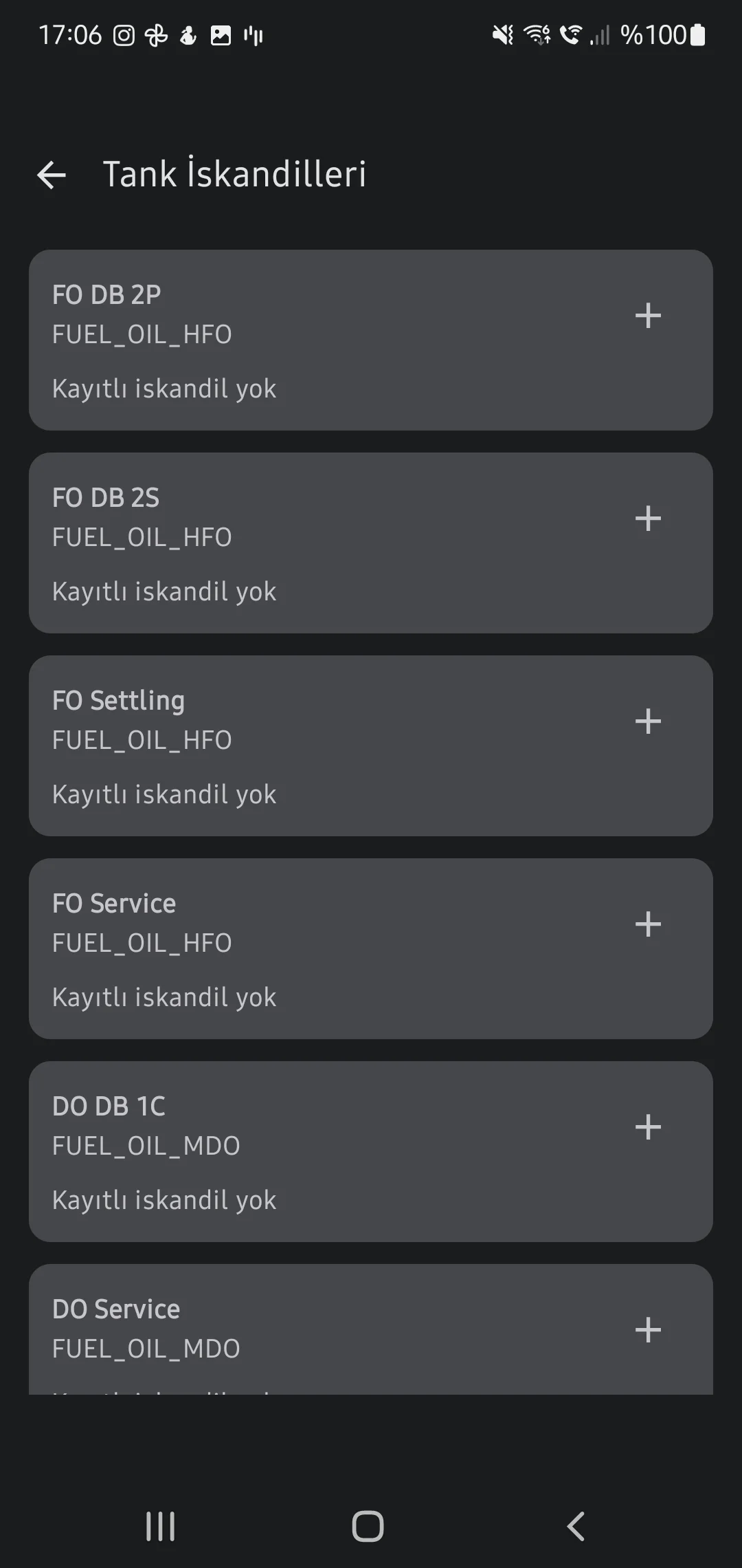
Cargo Loading & Tank Soundings
Input hold cargo metrics and tank liquid volumes (ROB) to automatically gauge operational displacement and dynamic Free Surface Moments (FSM).
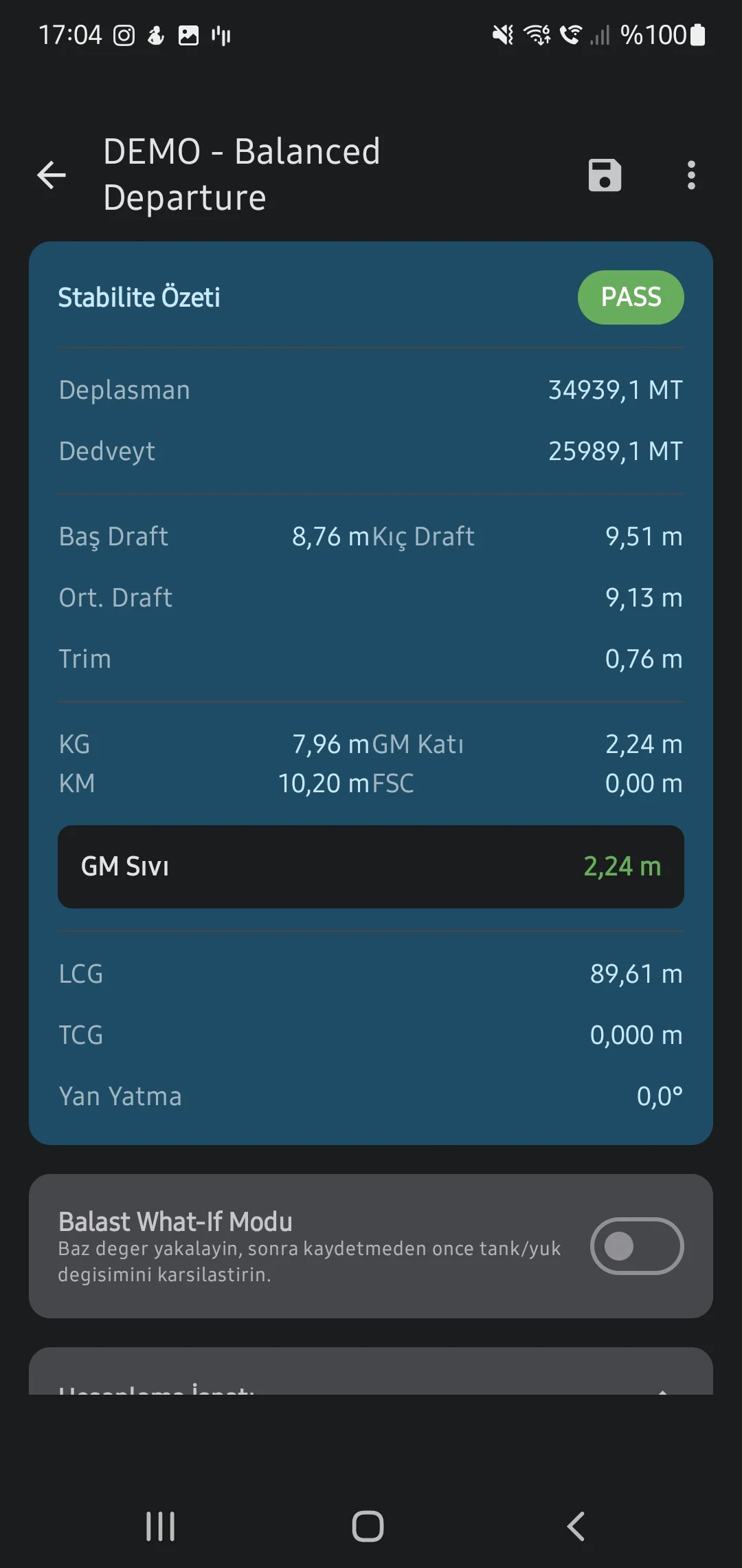
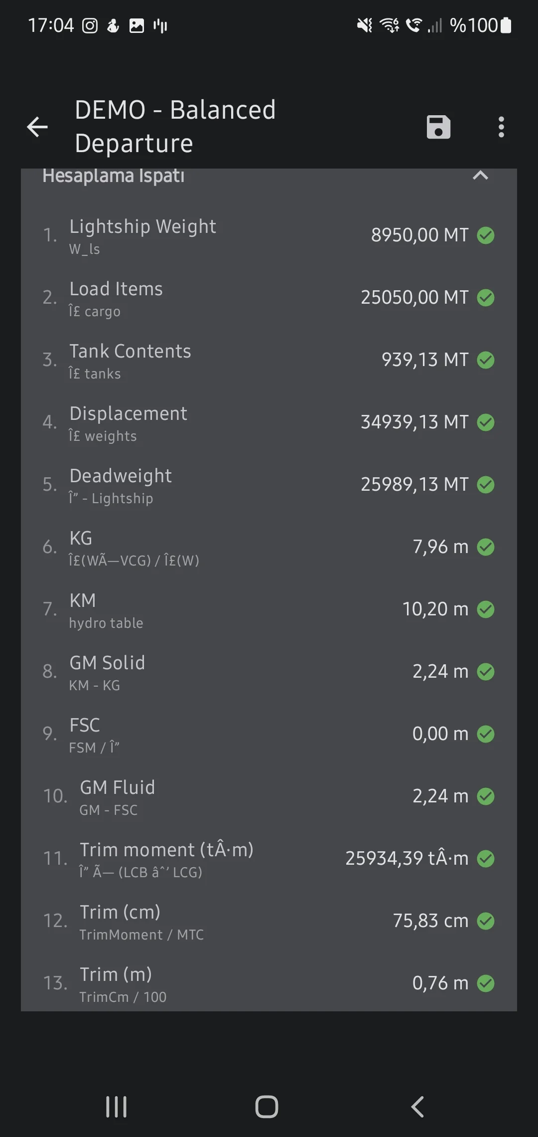
Stability Cases & Intact GZ Curve
Run distinct loading scenarios to instantly verify Metacentric Height (GM) and plot Righting Levers (GZ) against strict Intact Stability codes alongside real-time UKC monitoring.
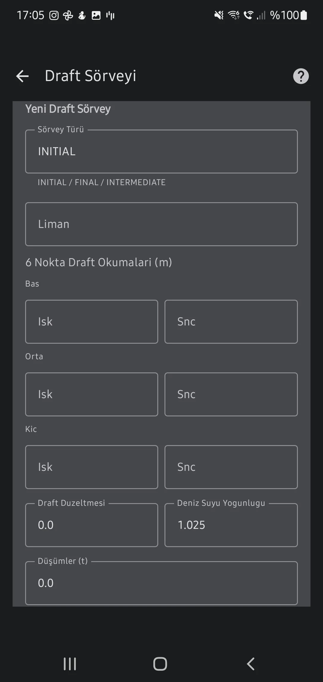
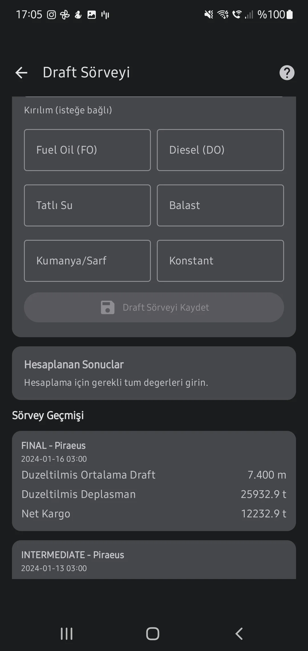
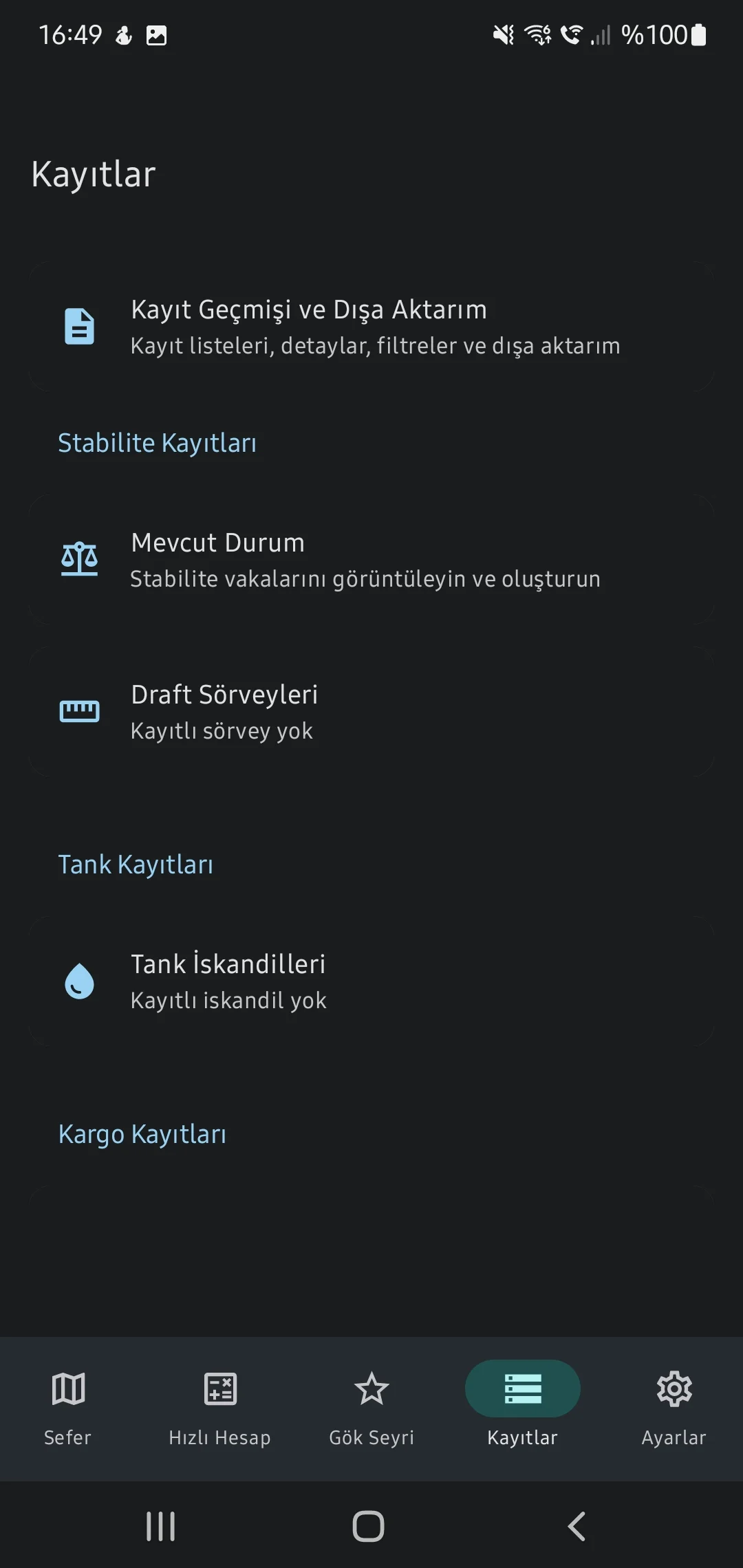
2. Draft Survey
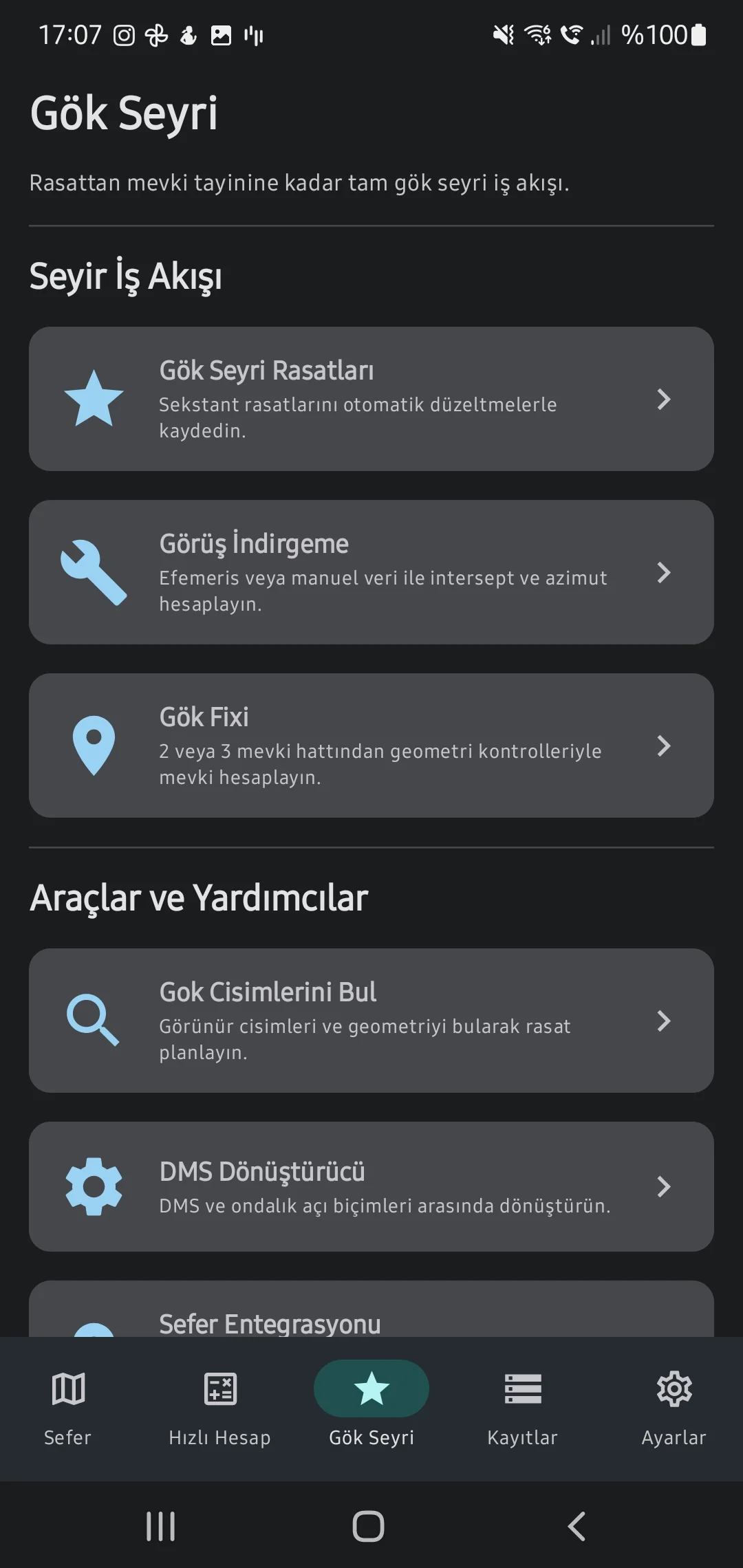
3. Celestial Navigation
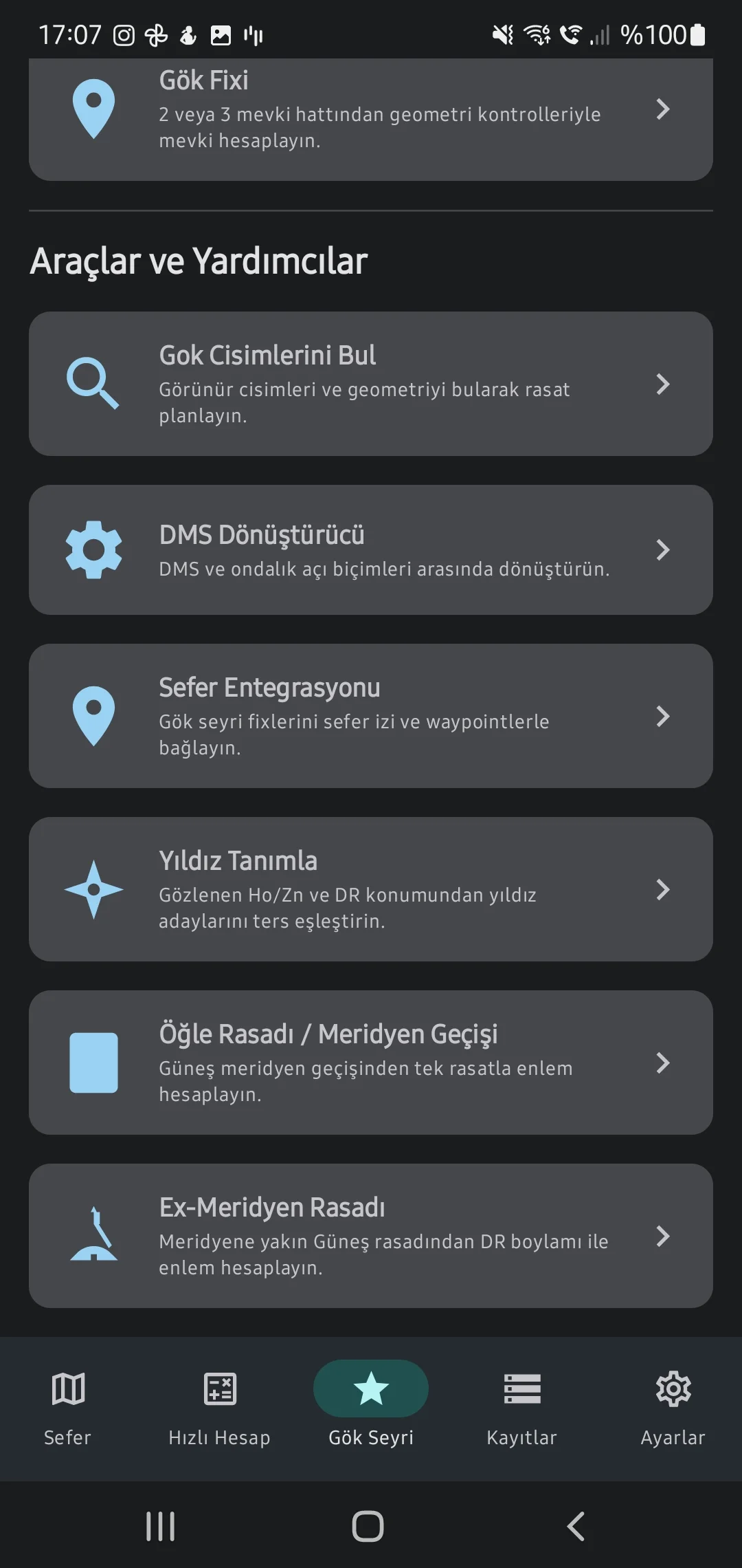
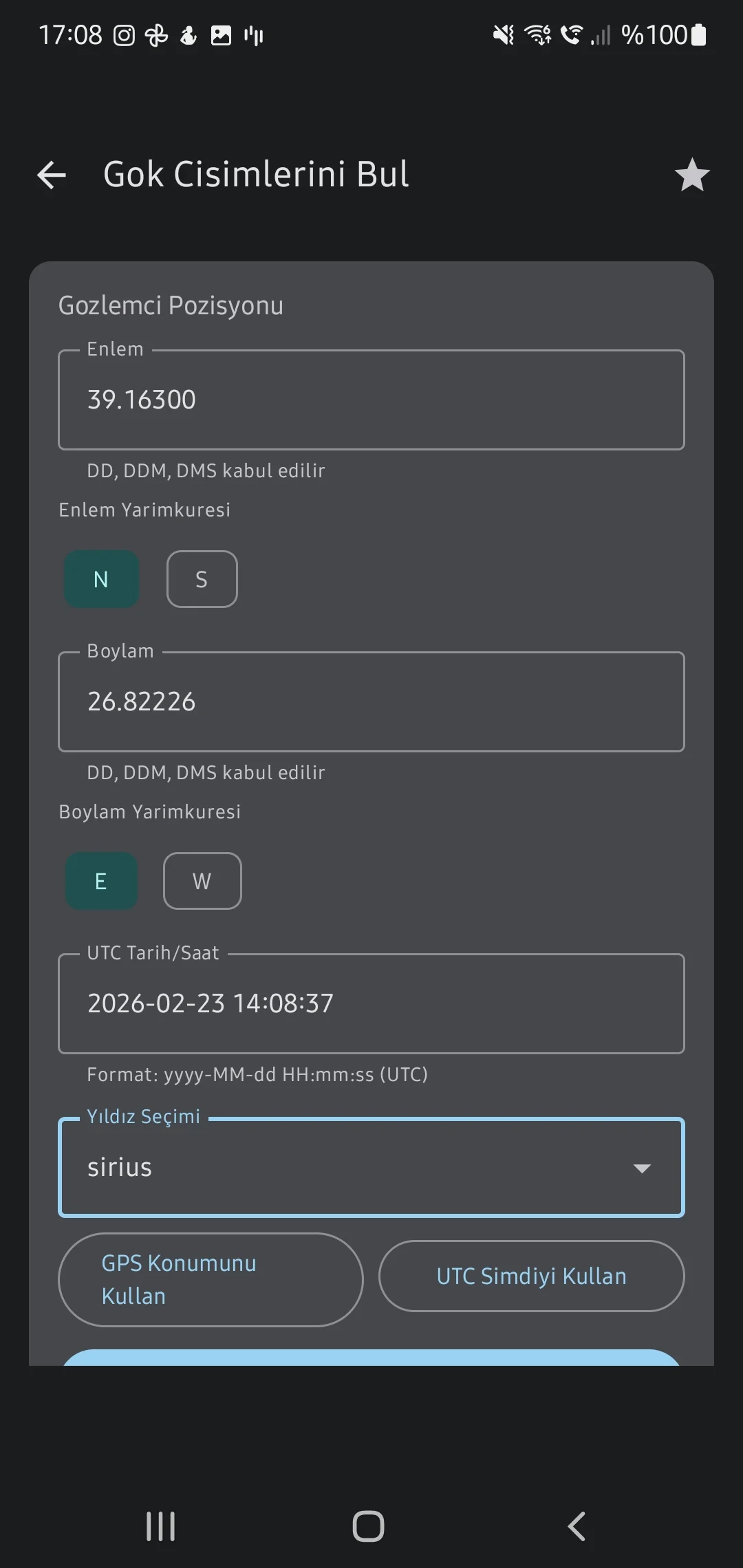
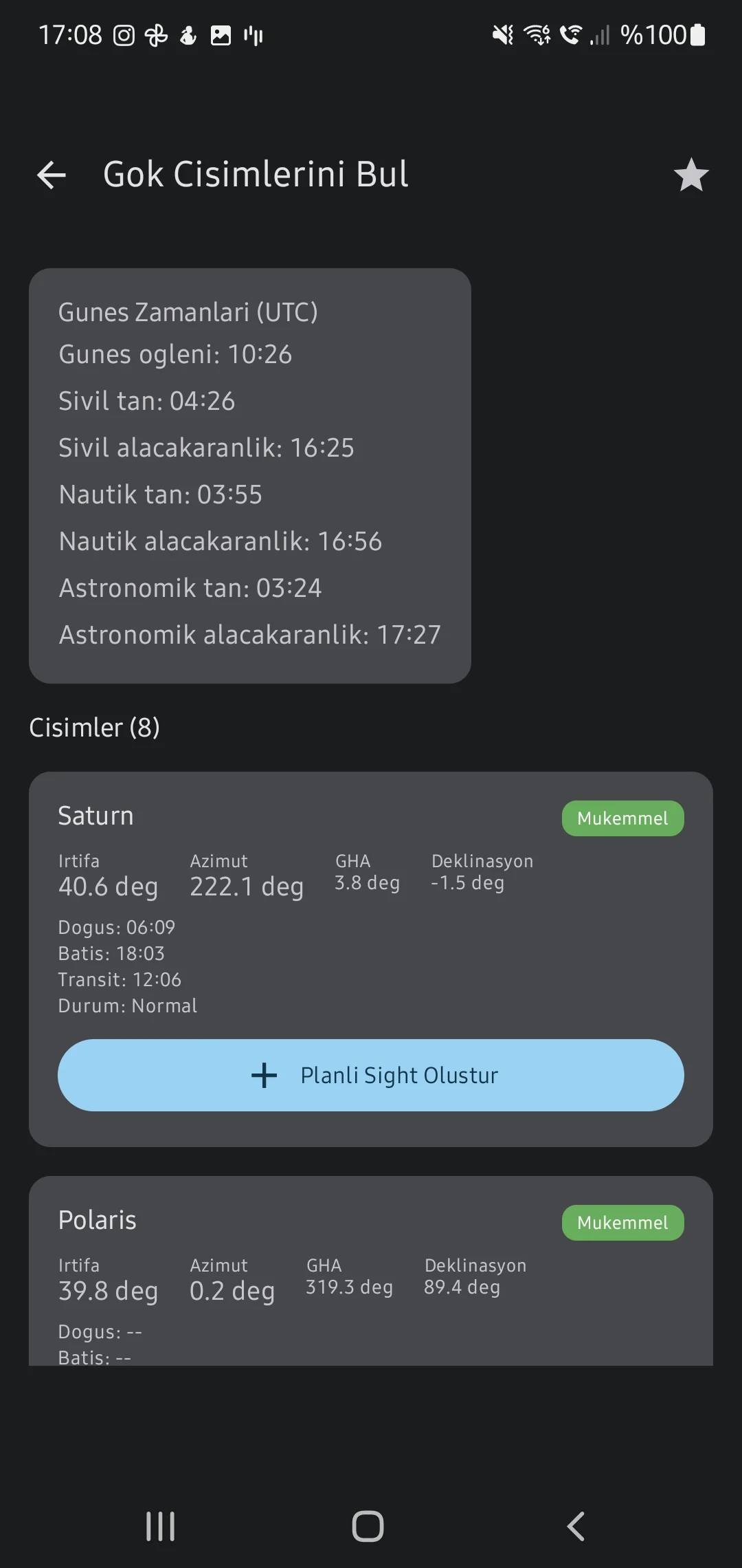
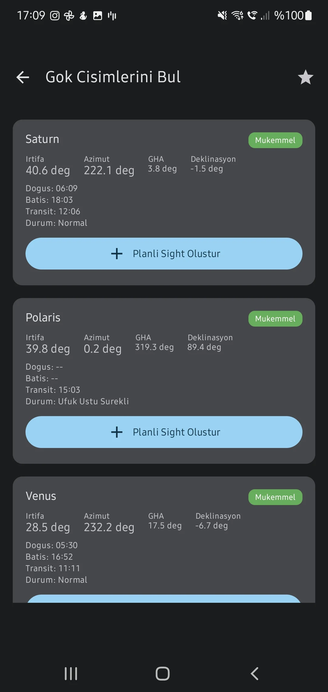
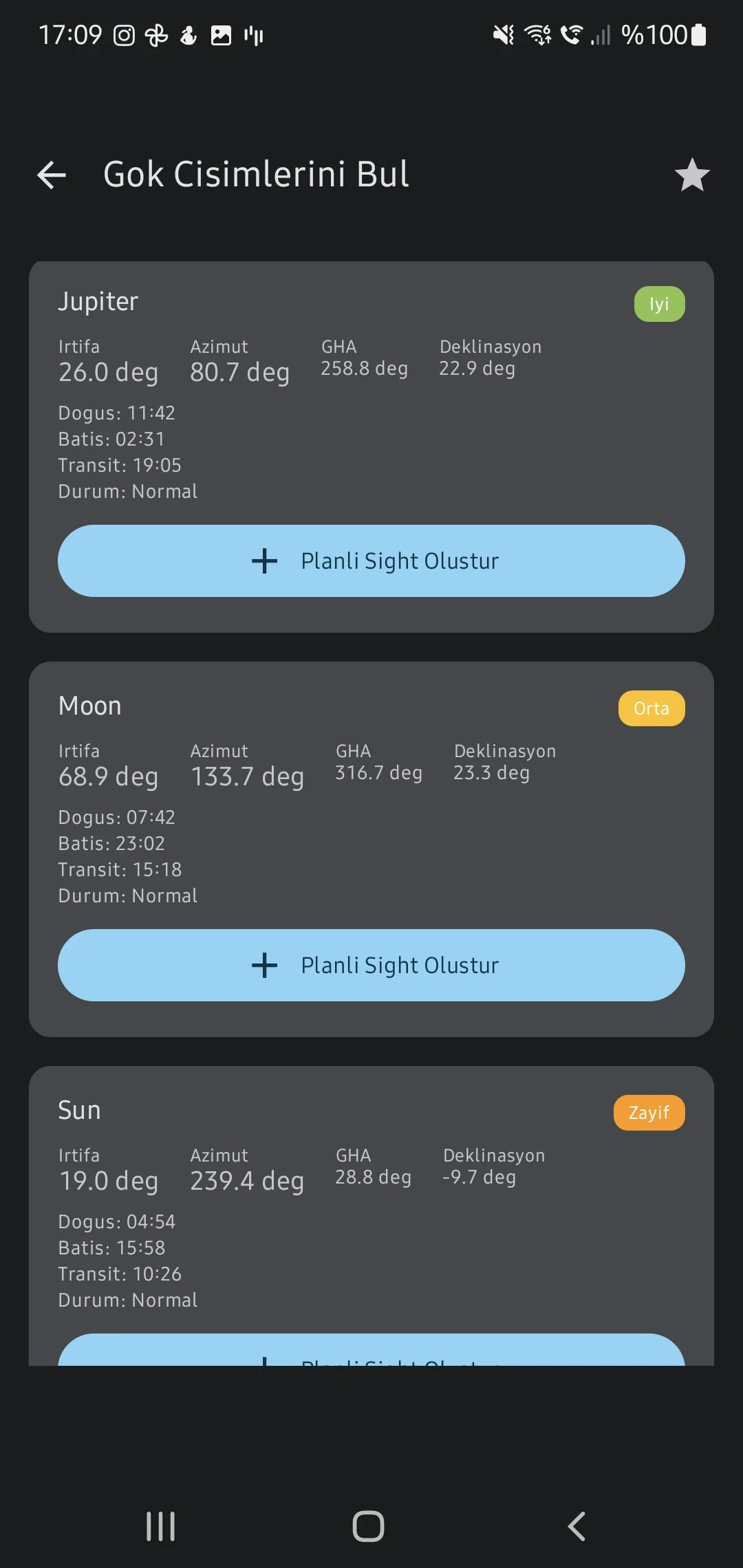
Almanac & Star Finder (Identify)
Determine exact Twilight, Meridian Passage, and azimuth/altitudes (Star Finder) for 57 standard stars allowing bridge teams to locate unknown bodies against the horizon.
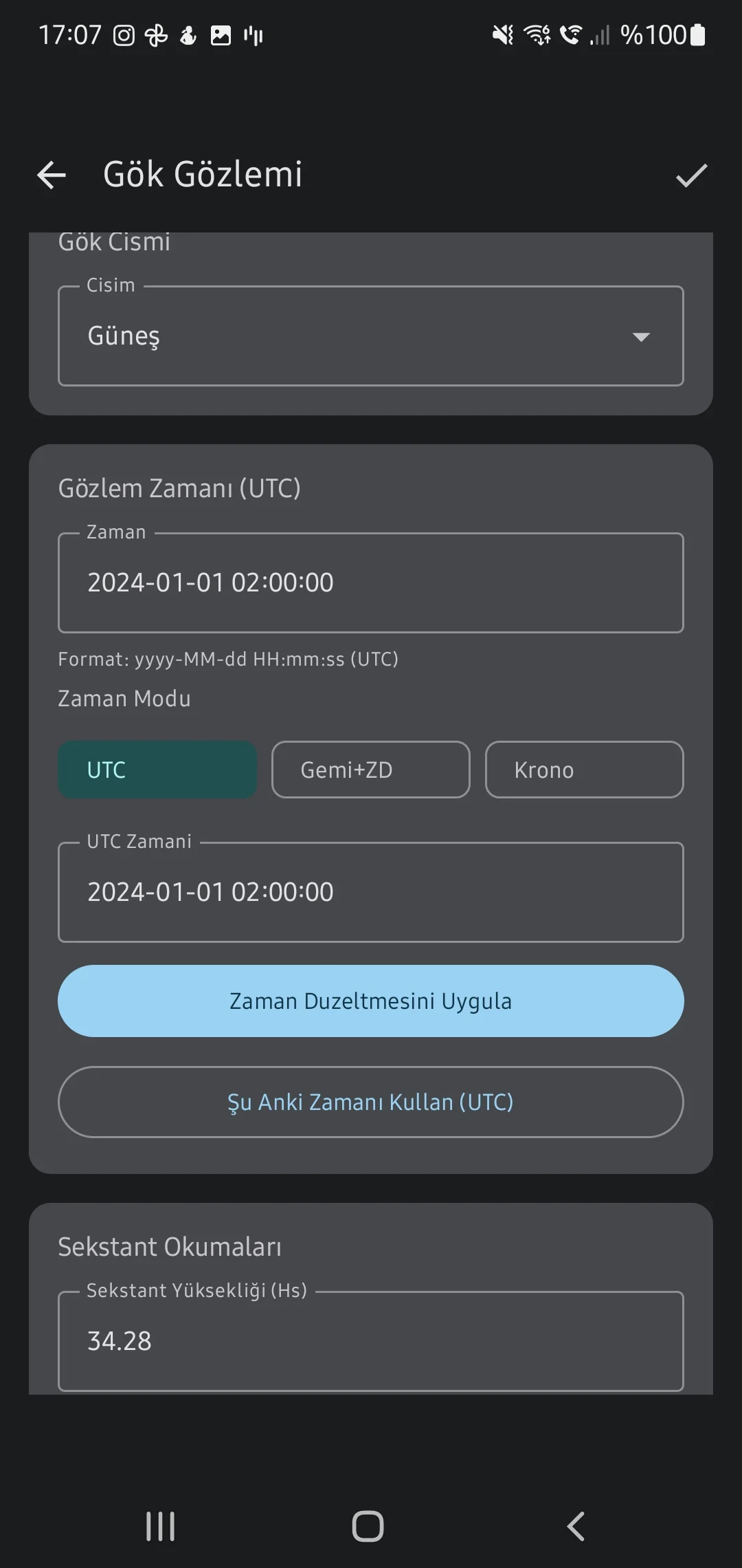
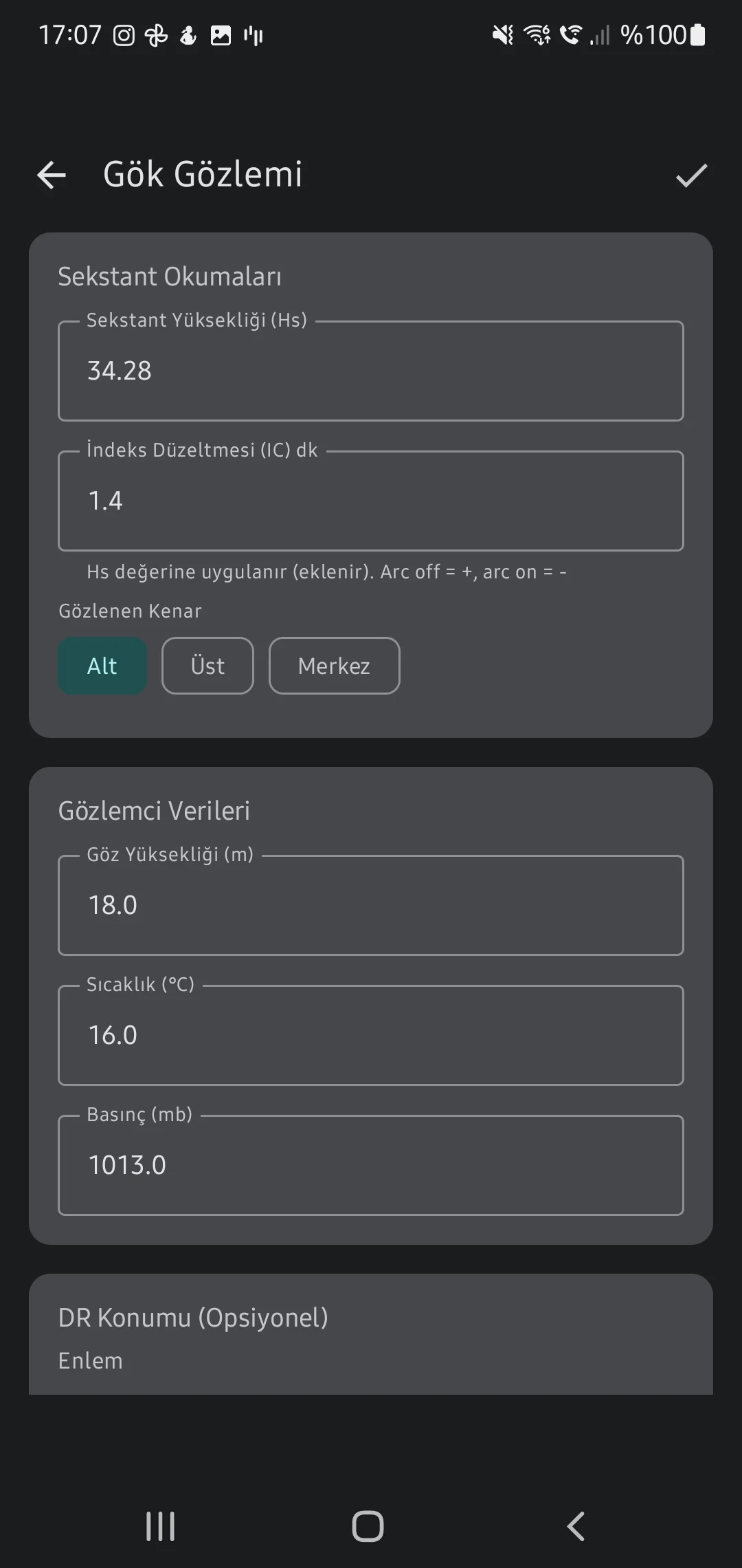
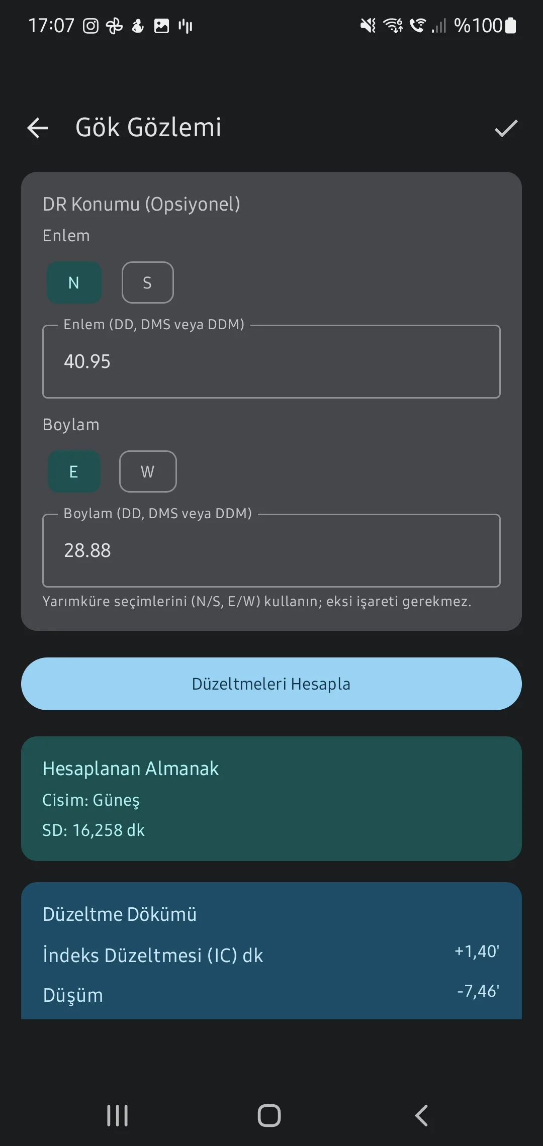
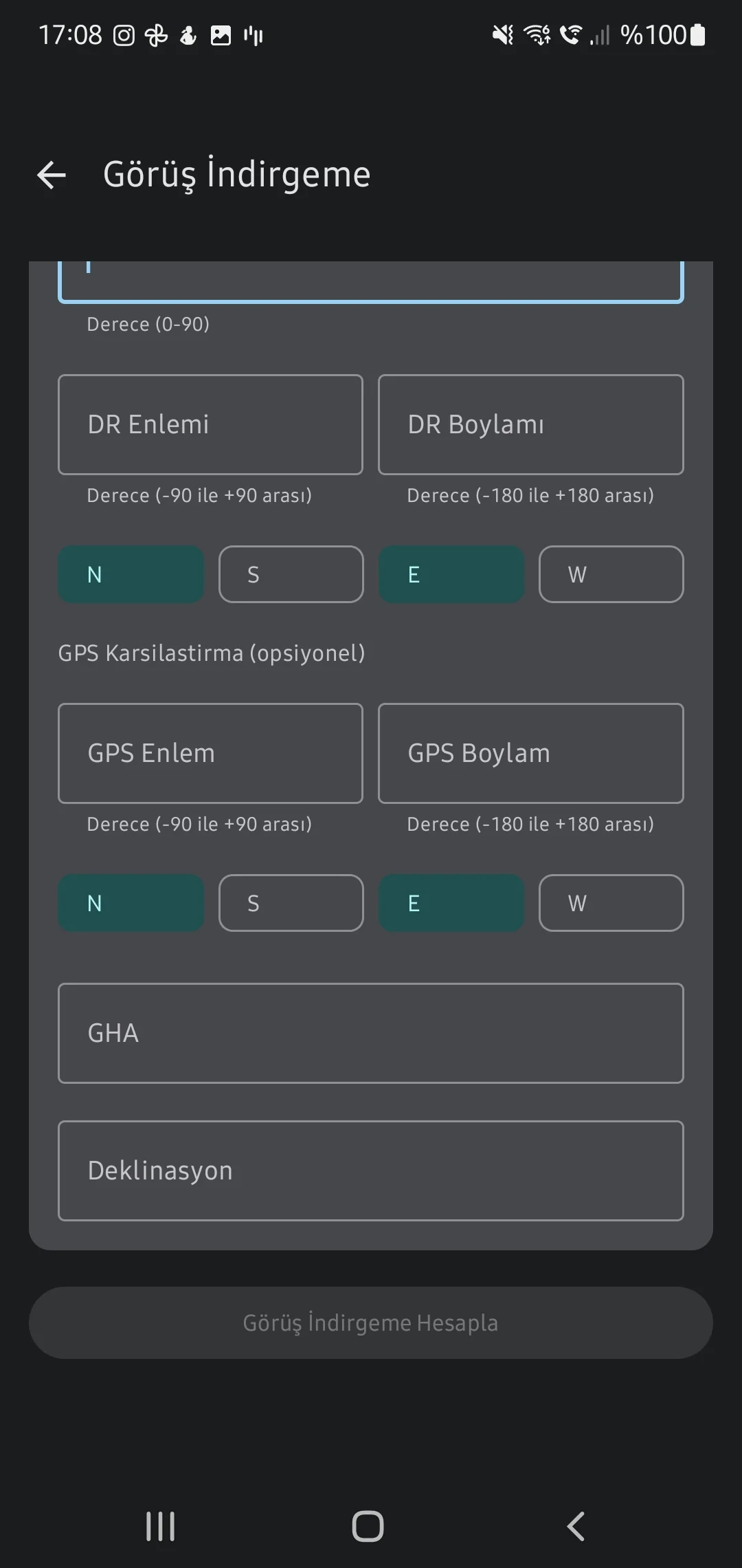
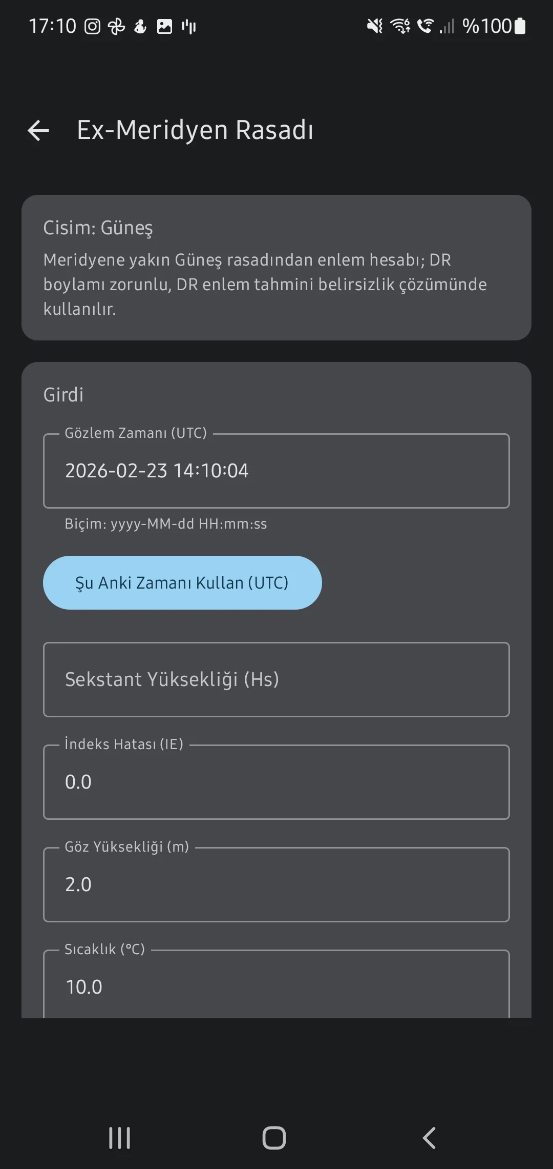
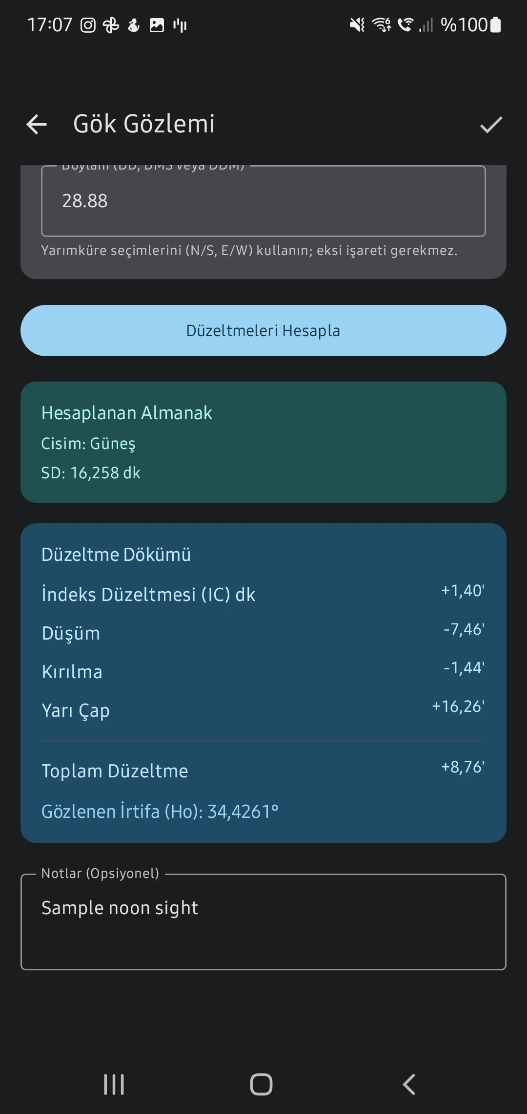
Sight Reduction
Refine raw Sextant Altitudes (Hs) using Dip, Index error, and atmospheric refraction equations to yield Observed Altitude (Ho) and Computed Altitude (Hc).
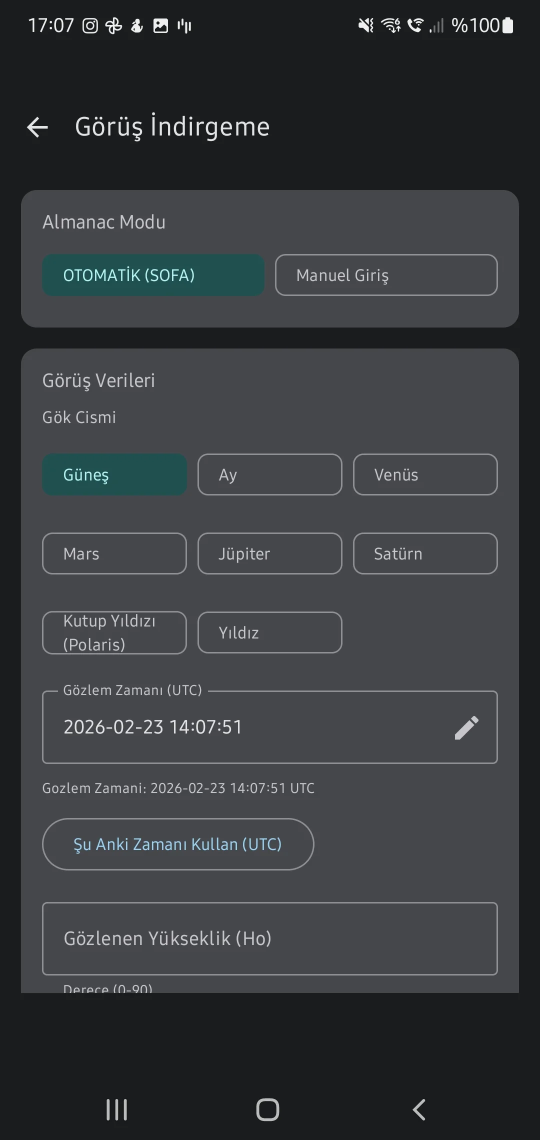
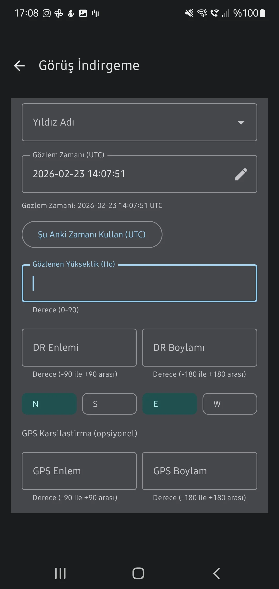
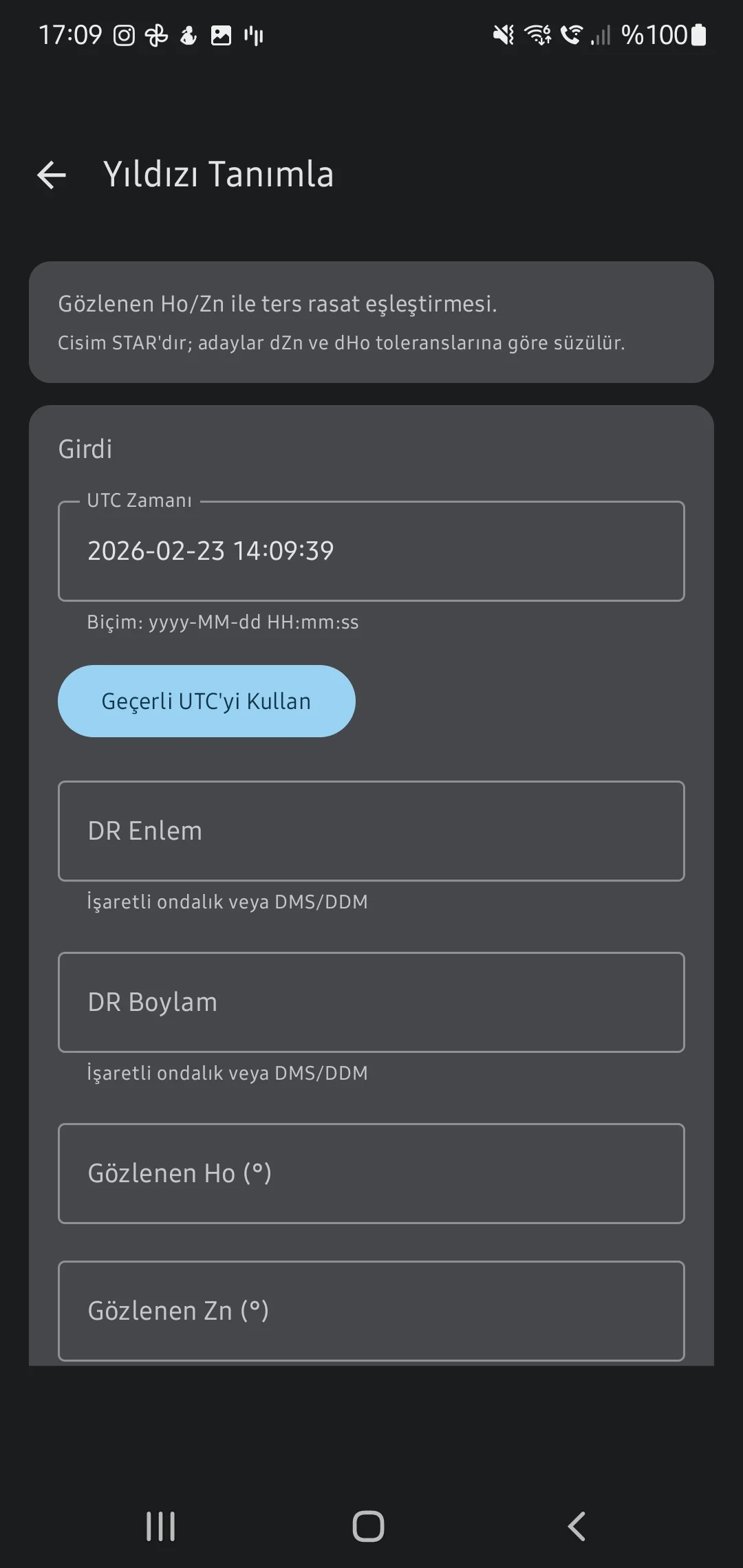
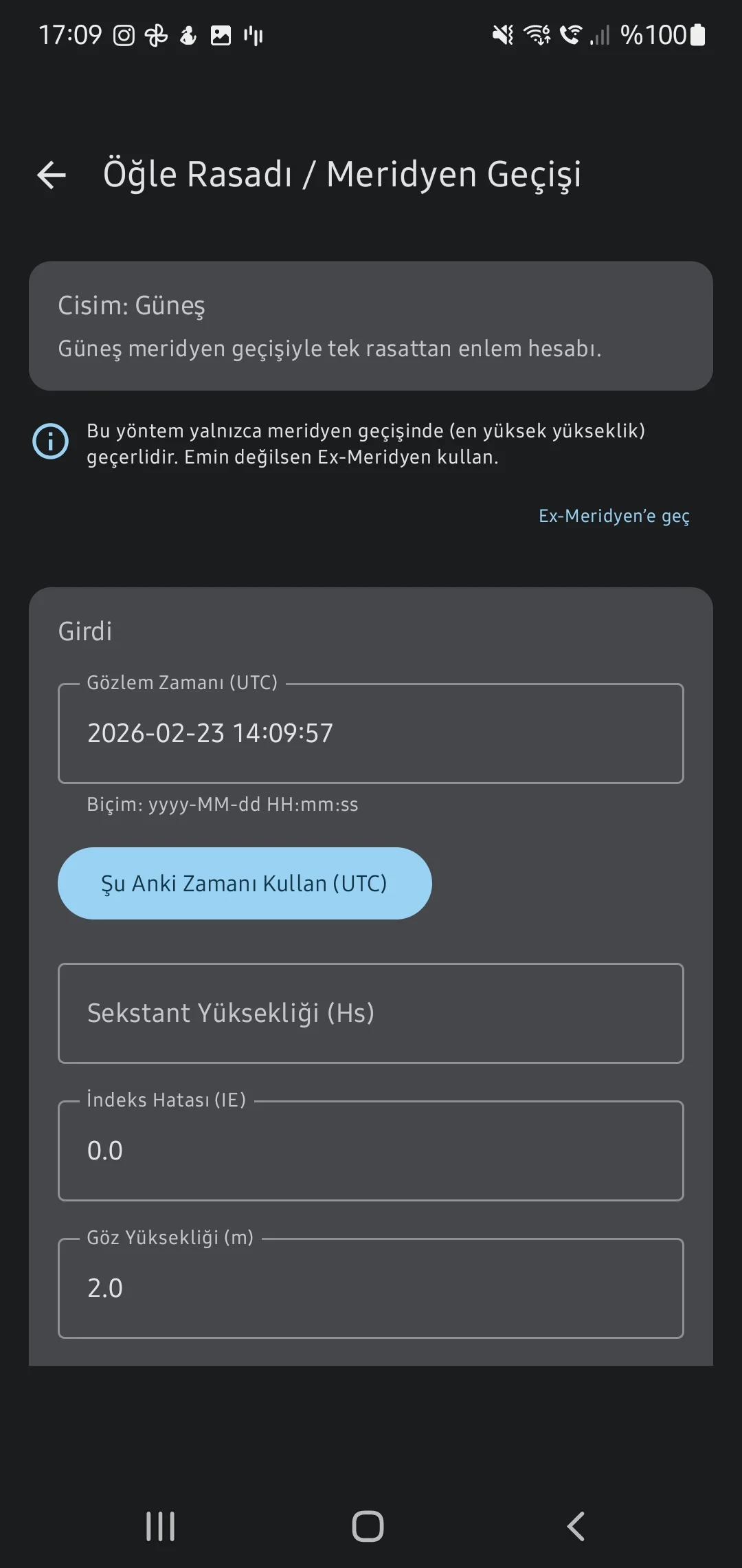
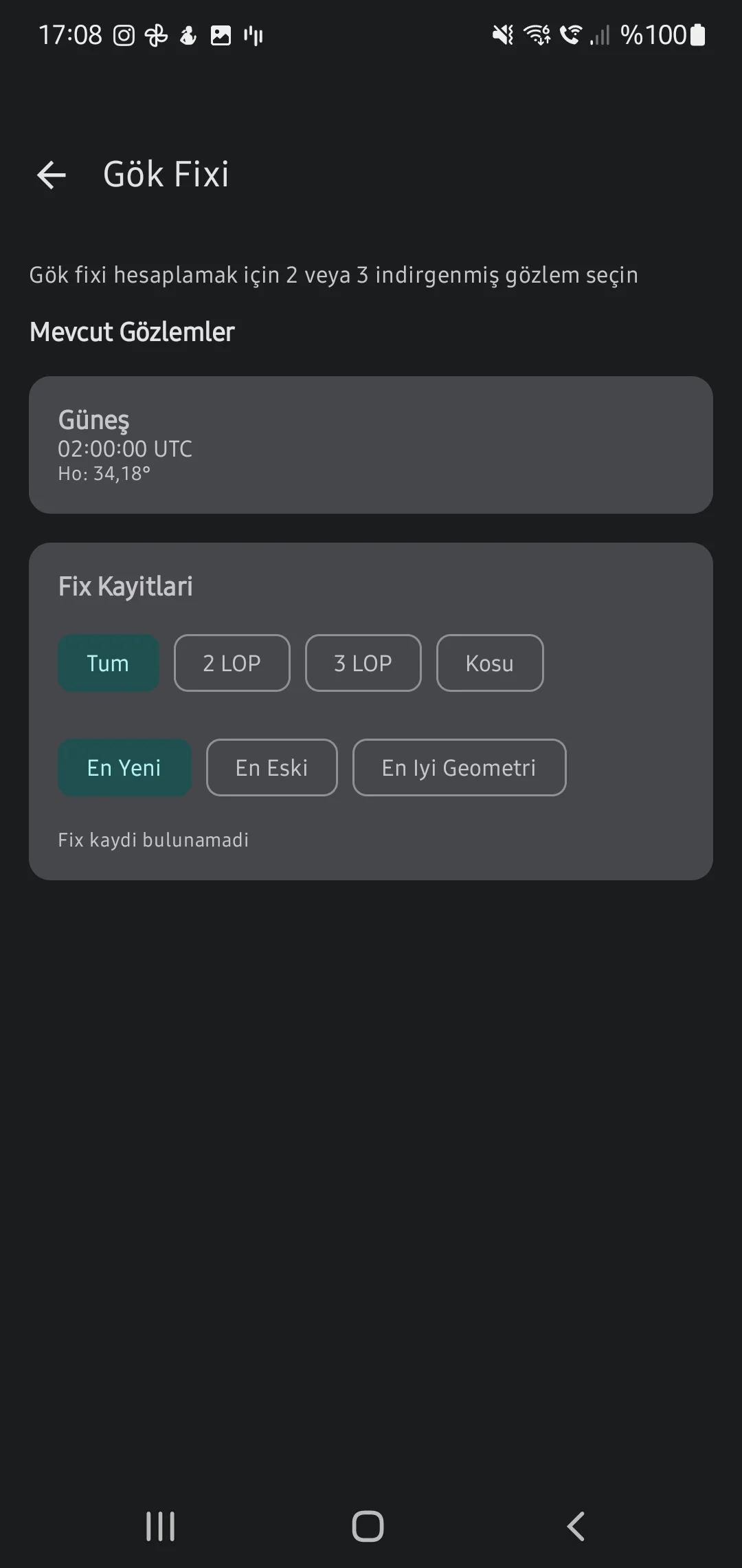
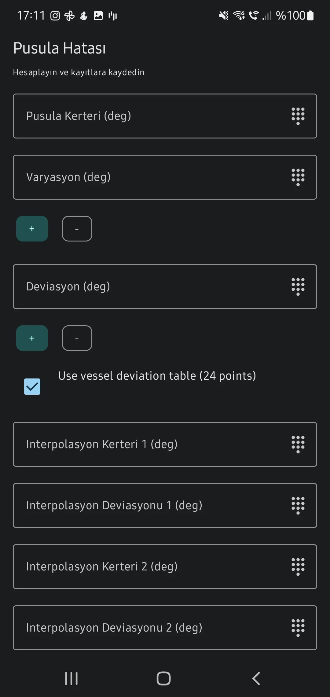
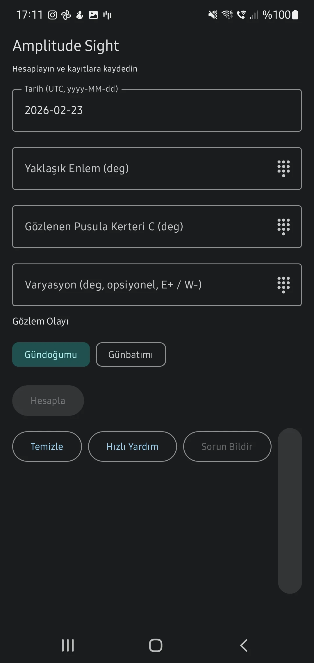
Celestial Fix & Compass Amplitude
Intersect multiple star Lines of Position (LOP) to pinpoint a standard Astronomical Fix, and plot true Sunrise/Sunset amplitudes to define precise gyro/magnetic compass deviance.
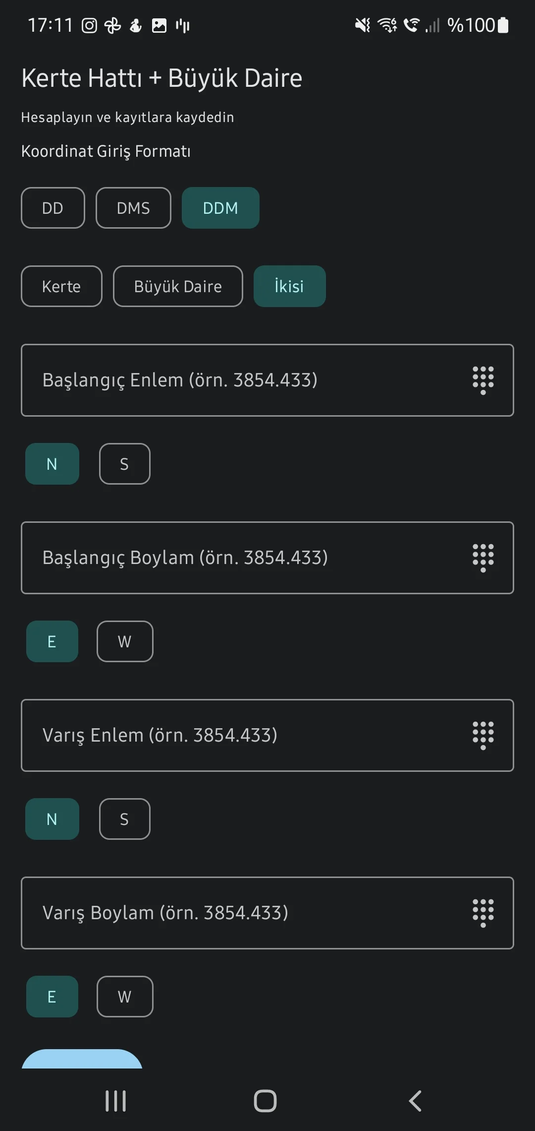
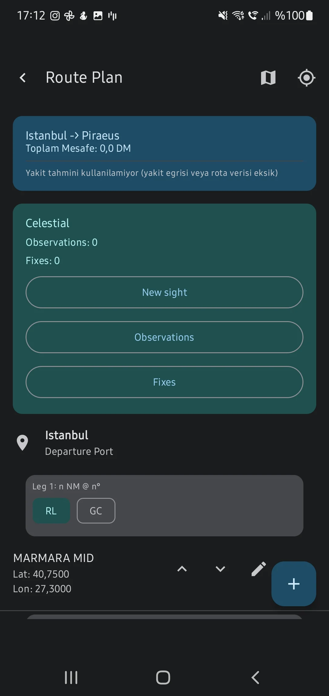
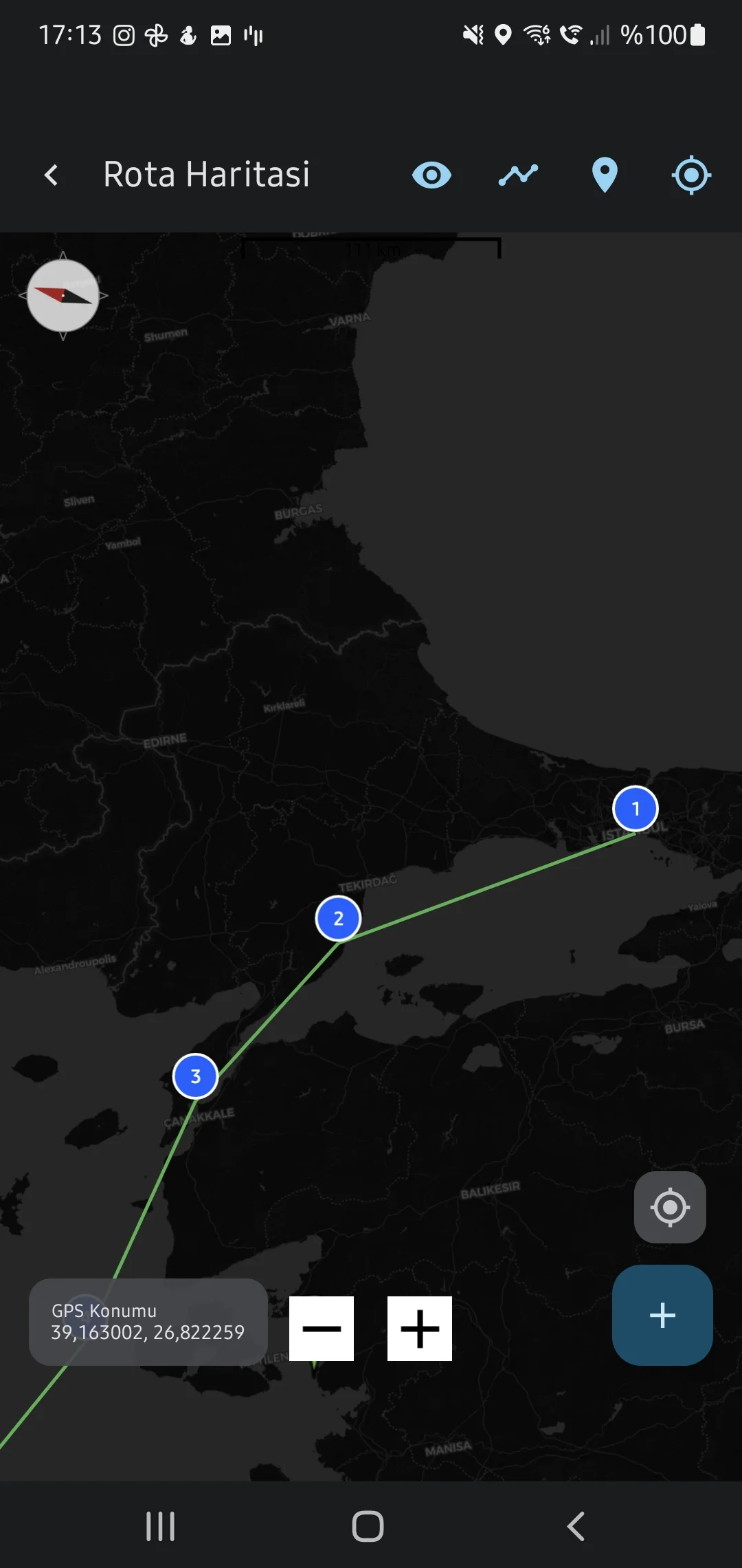
4. Voyage Planning & Routing

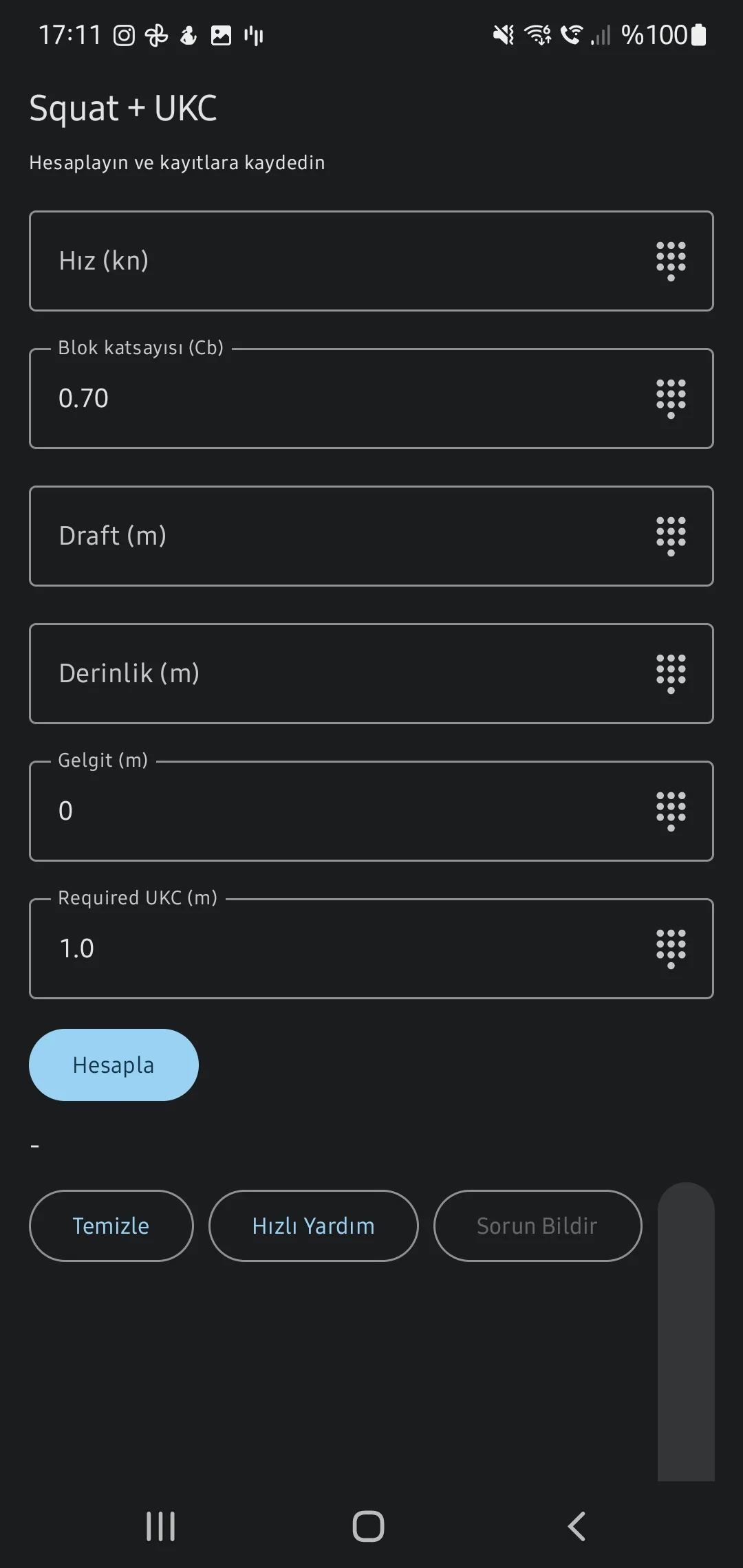
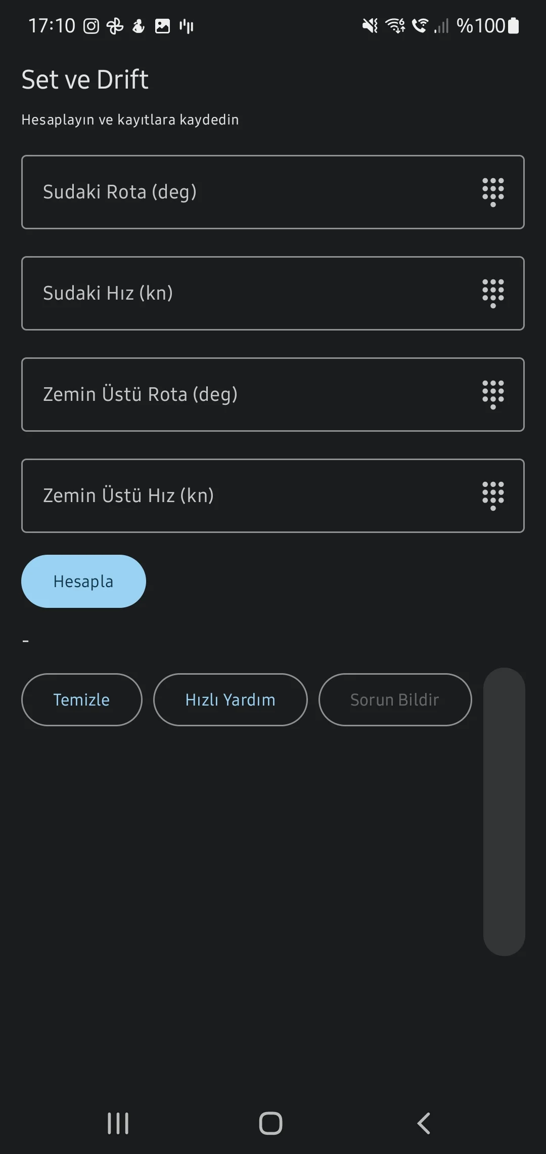
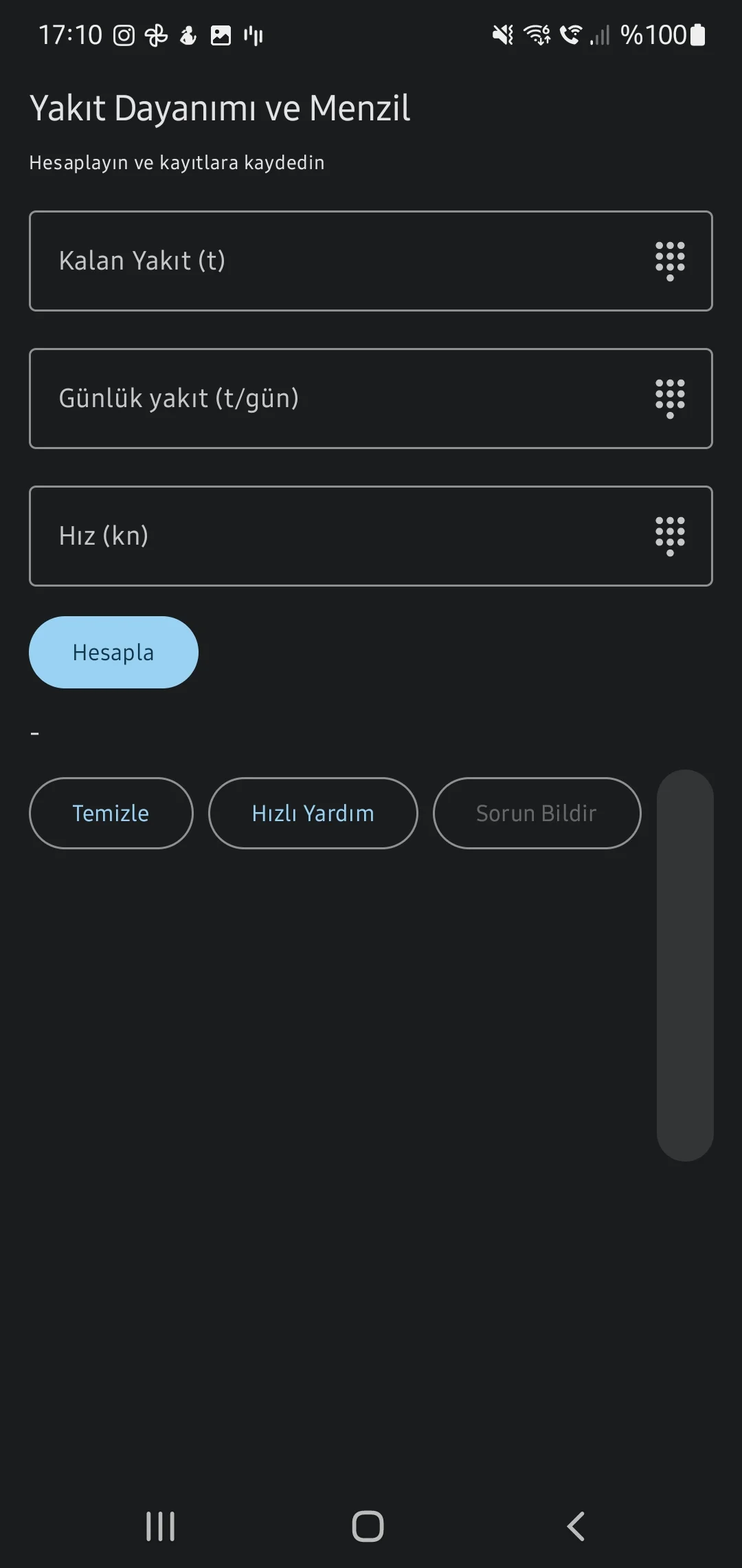
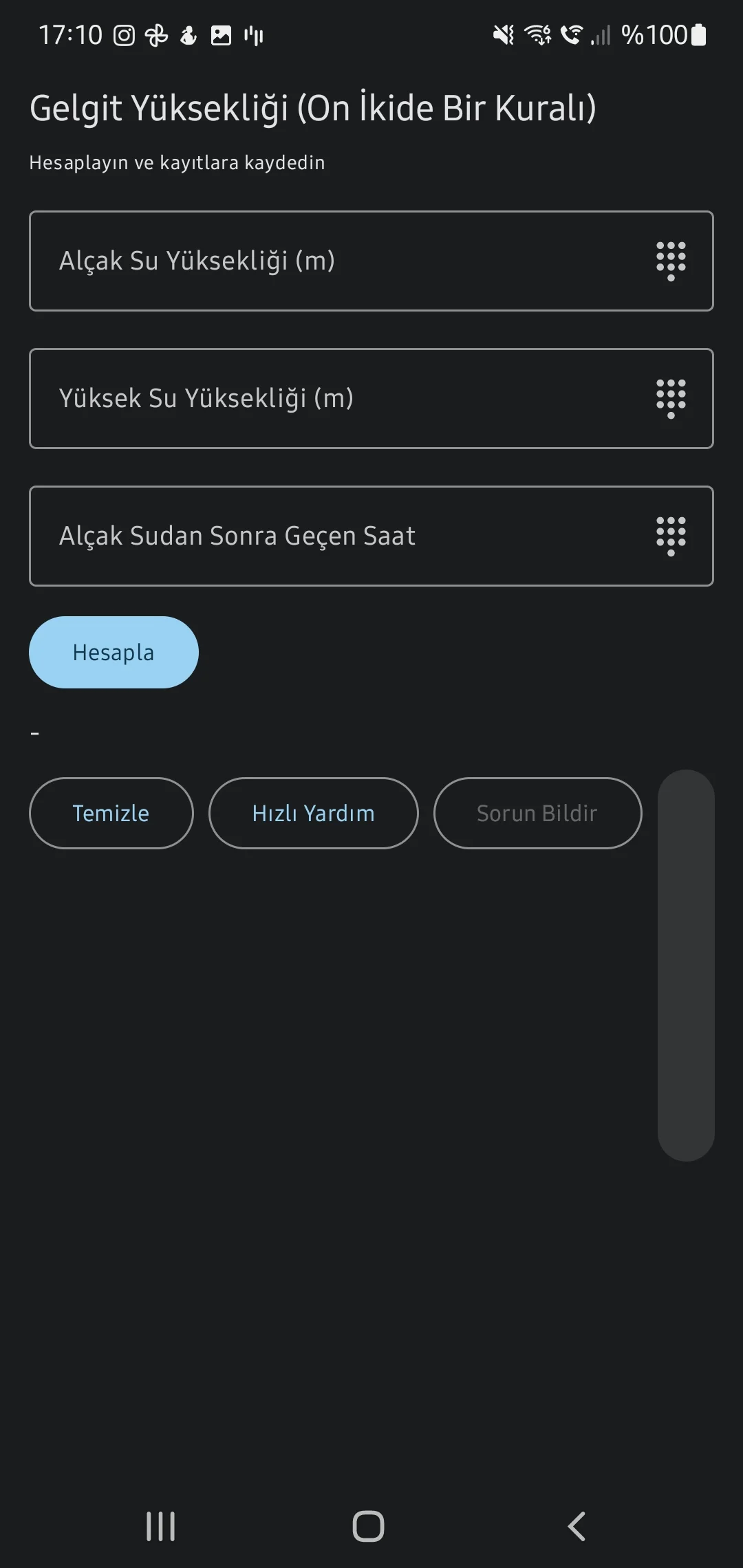
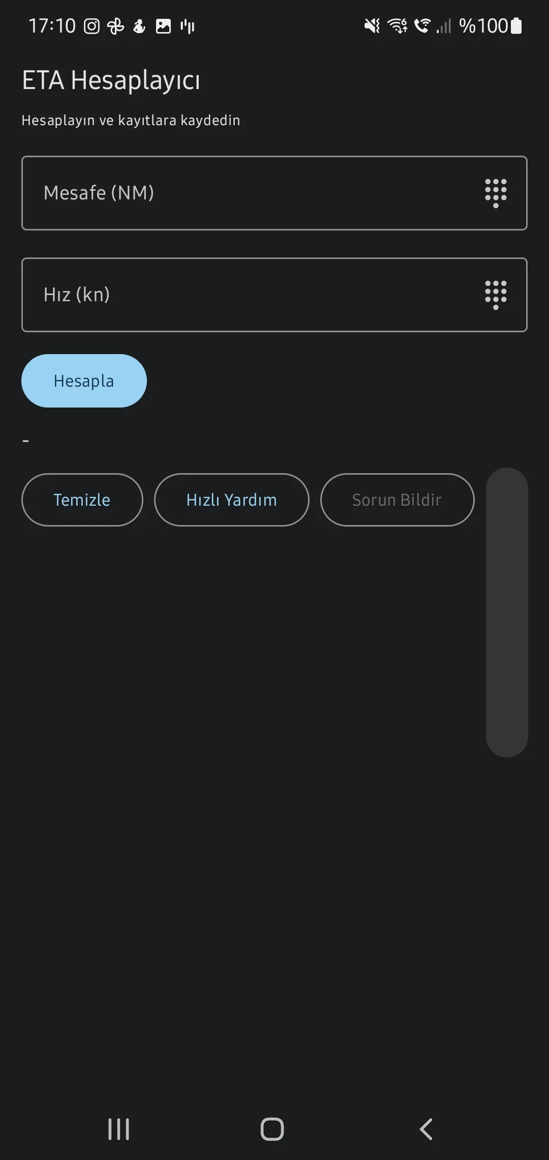
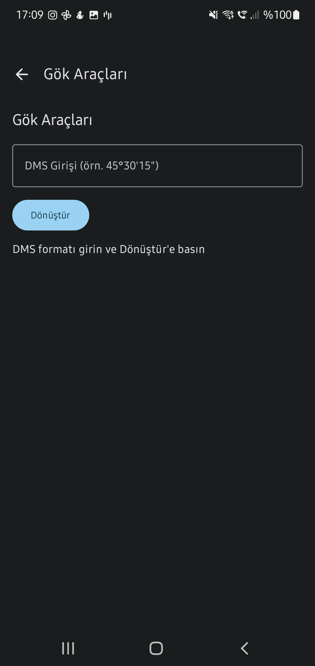
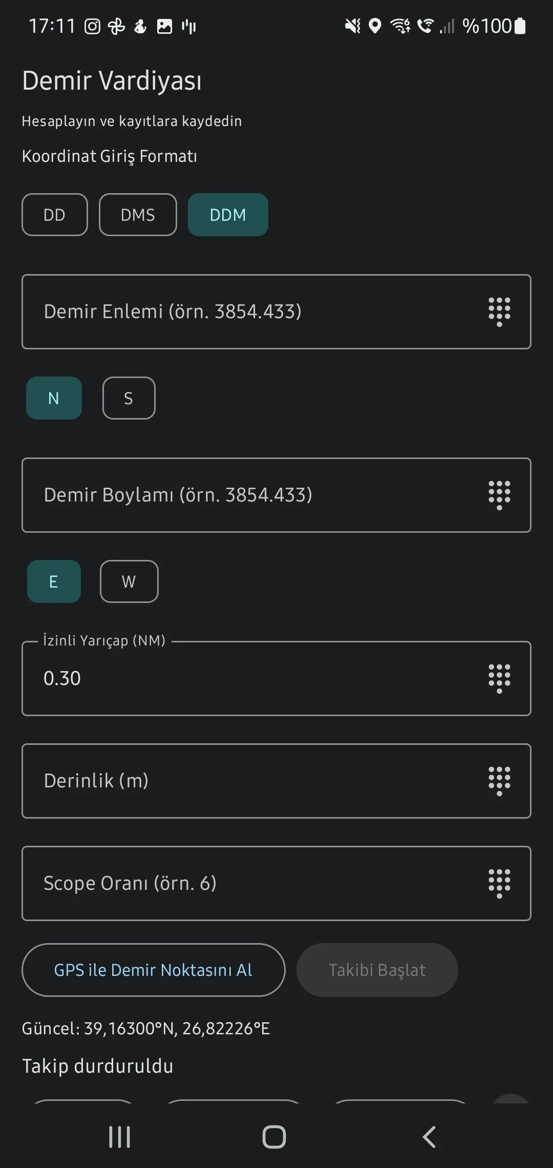
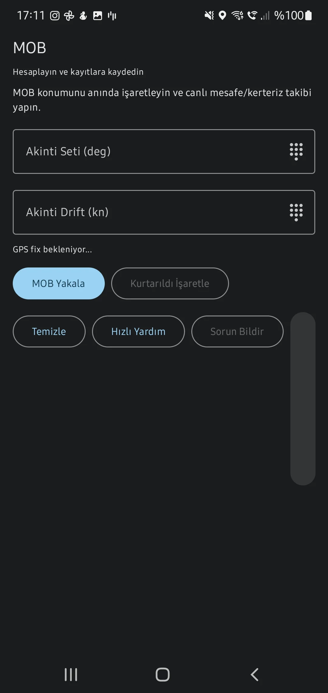
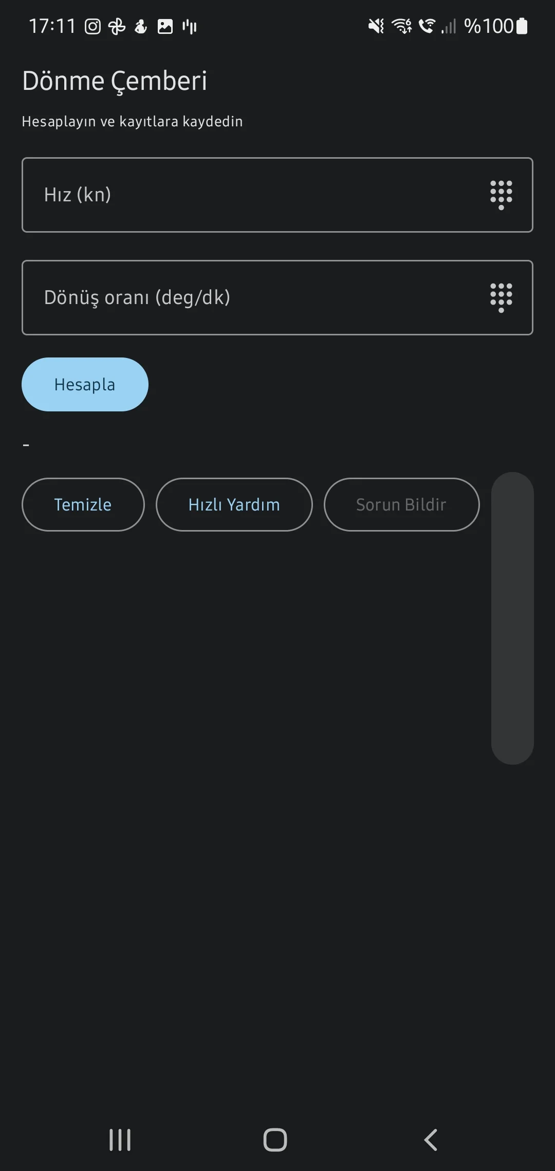
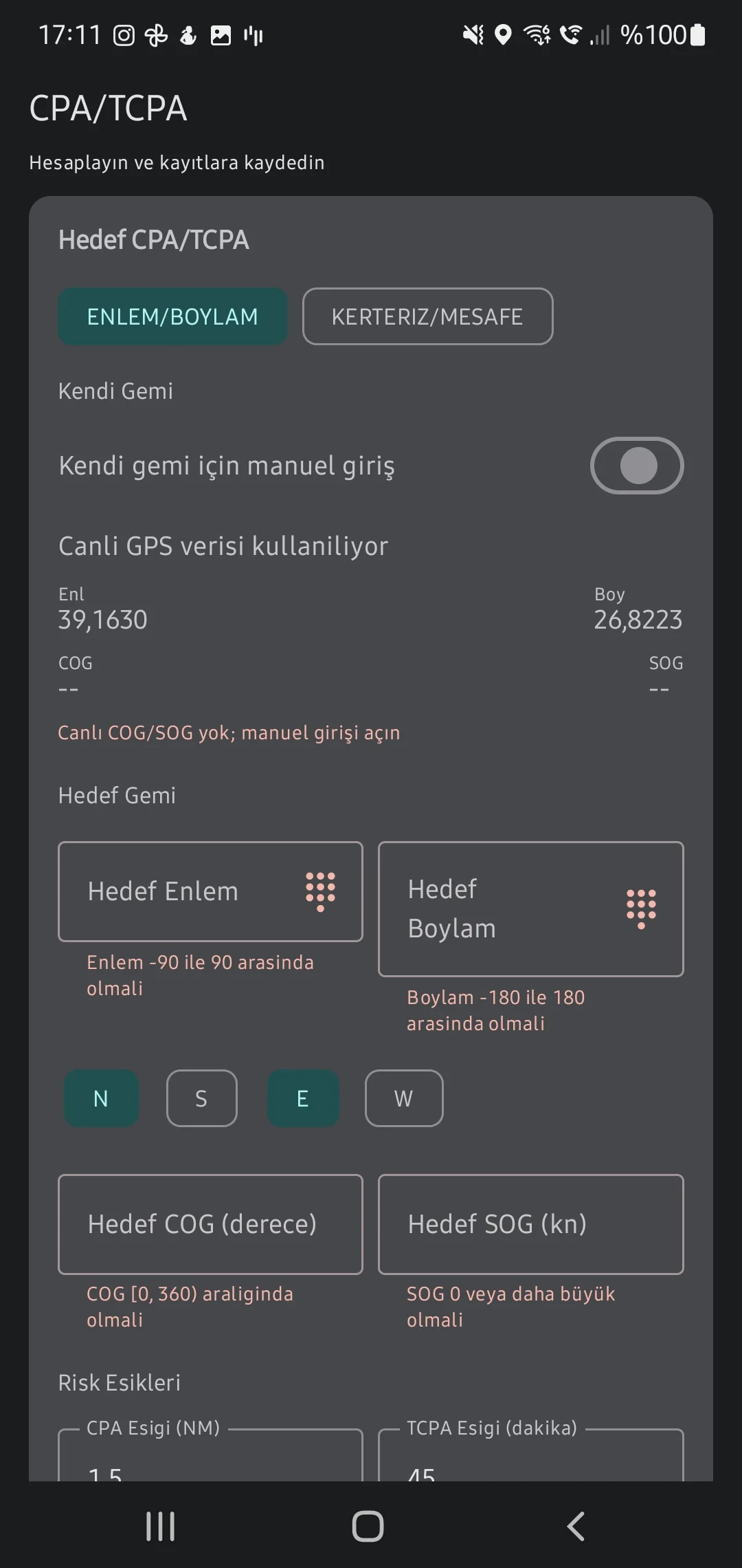
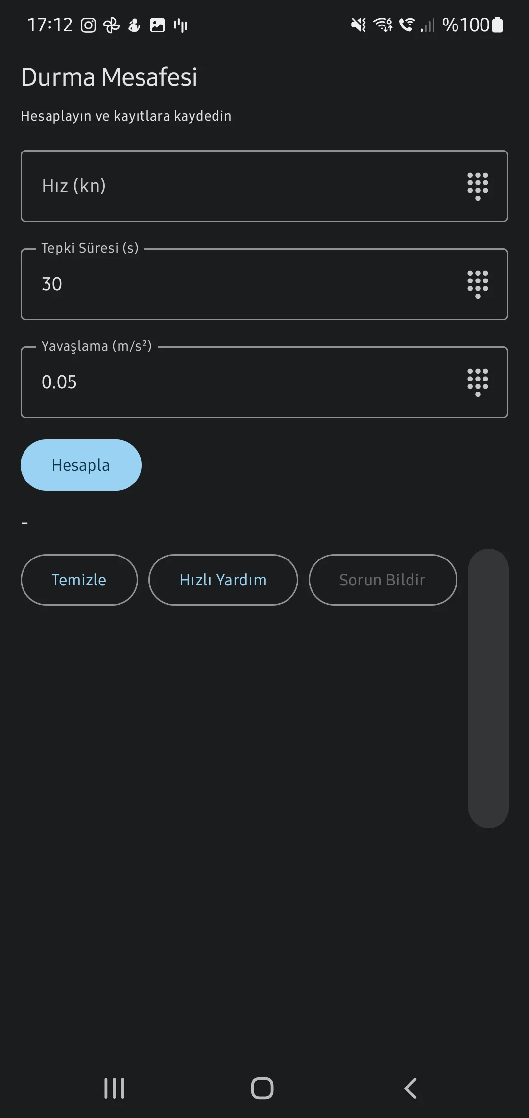
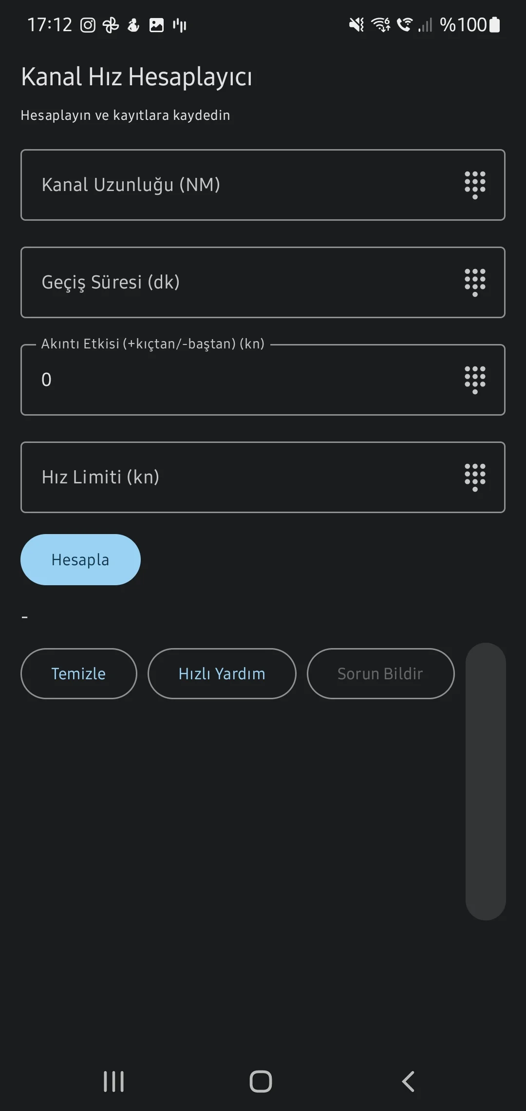
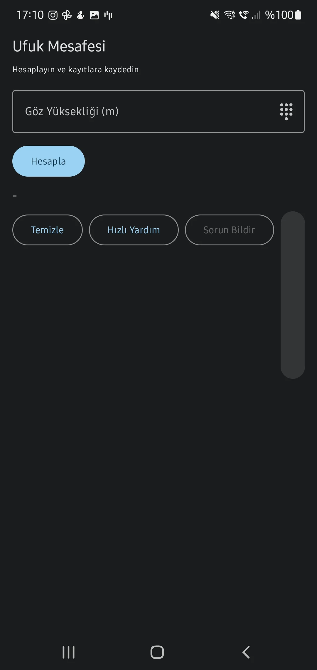
5. Quick Calcs
Standalone utilities specifically integrated to resolve immediate bridge watch safety boundaries and kinematic arrival predictions safely.
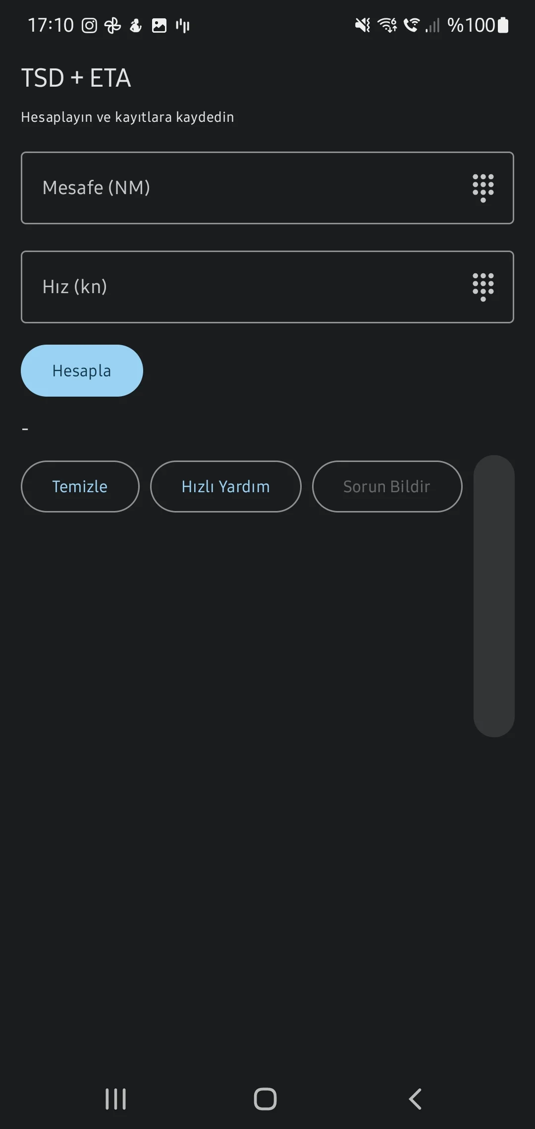
Time Speed Distance (ETA) & Drift
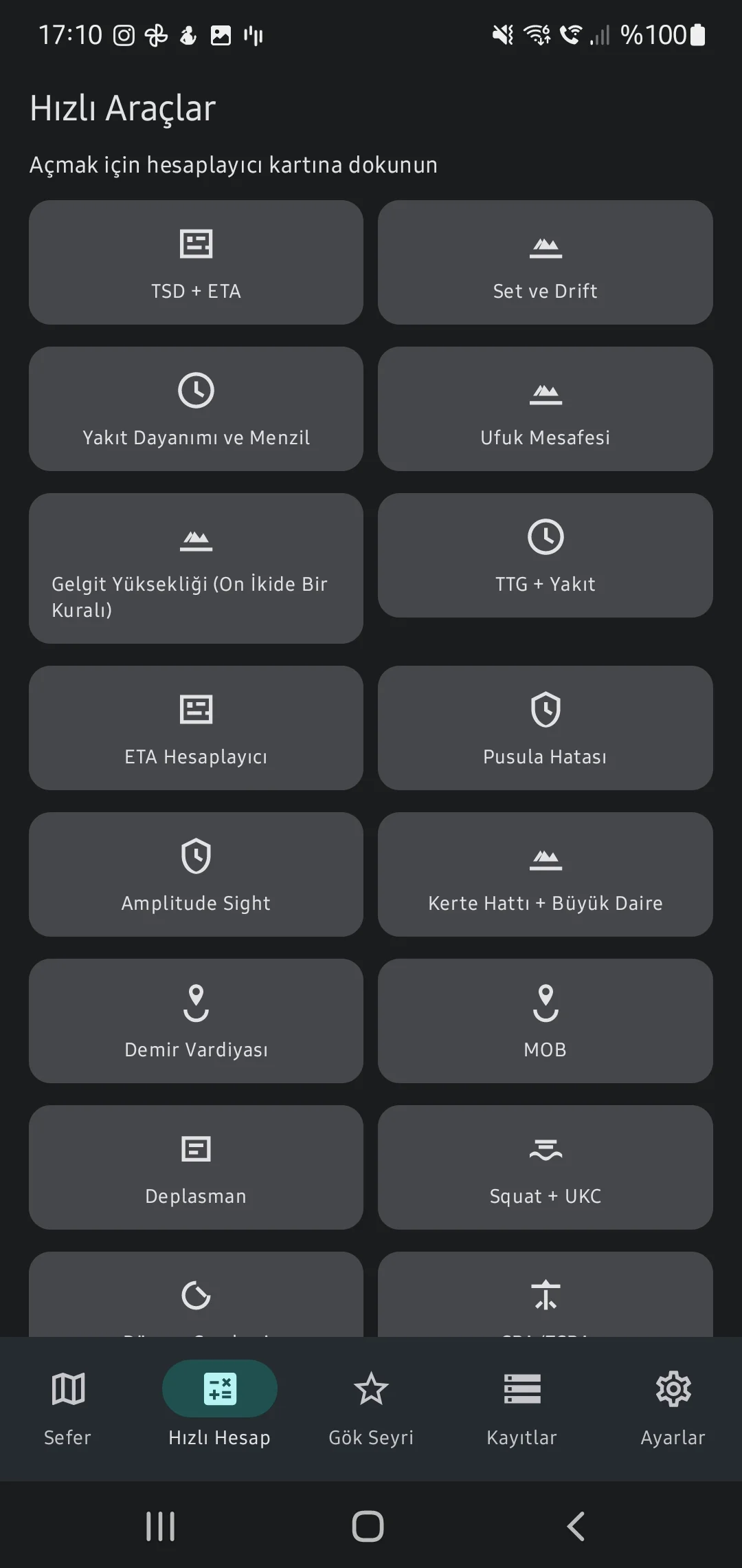

Safety Boundaries & Collision Math

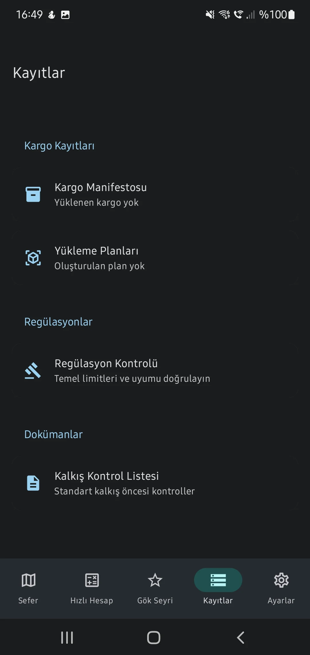
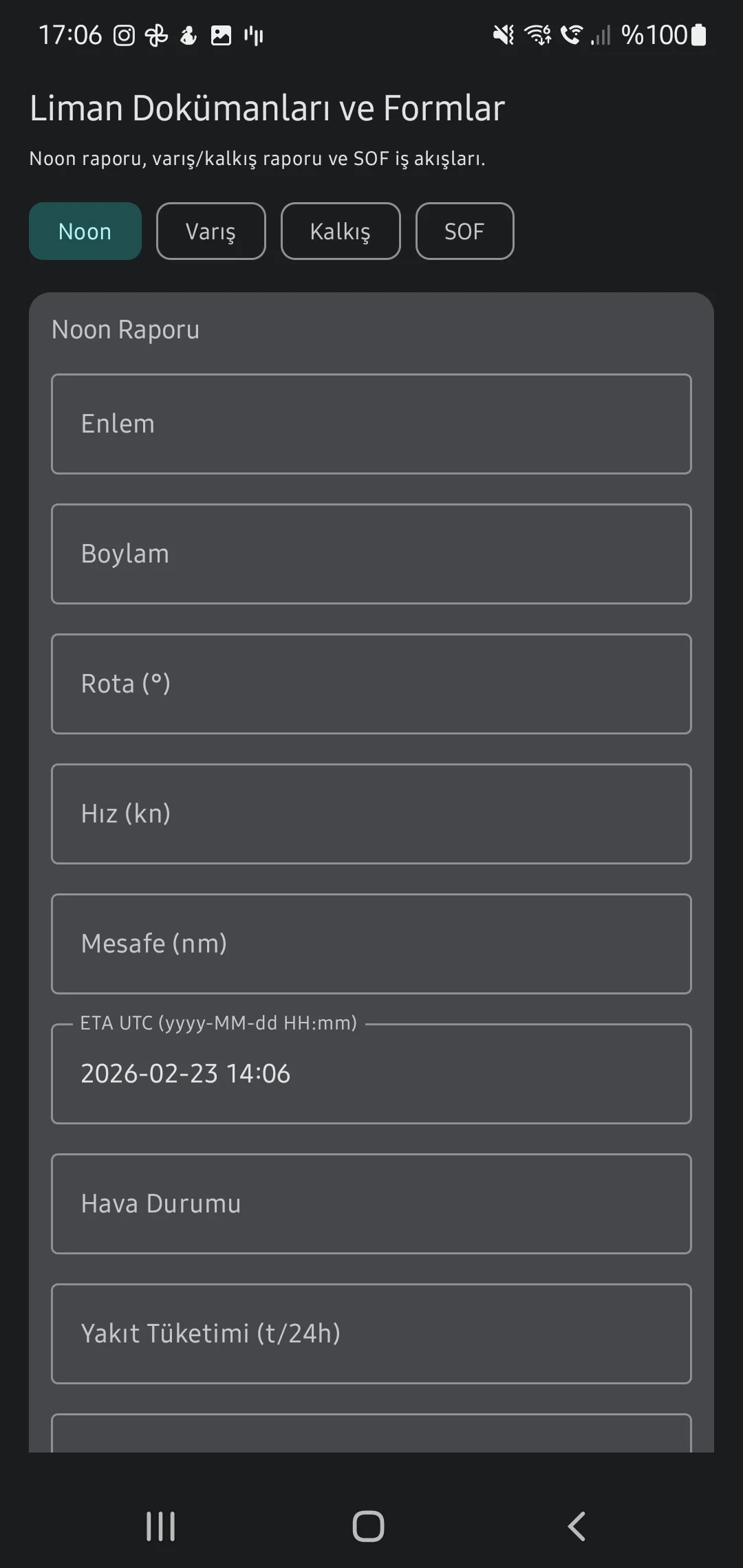
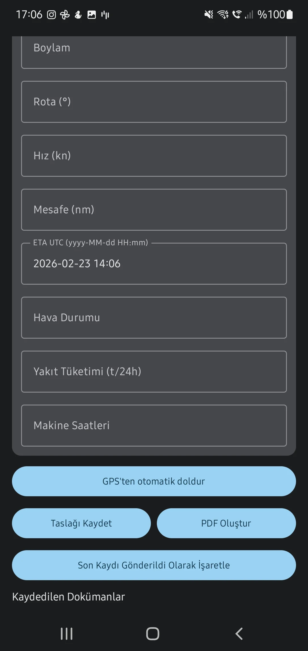
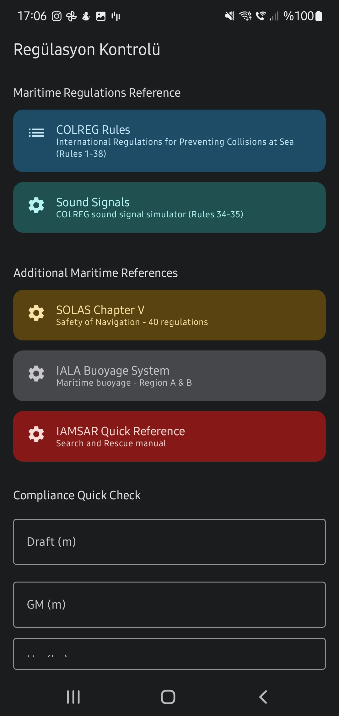
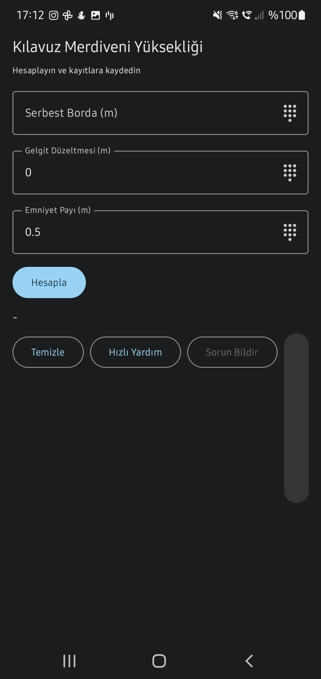
6. Checklists, Logs & Regulatory Info
Retain compliance with strict SOLAS criteria using visual Pilot Ladder rigging references, COLREG Lights & Shapes identifiers, and detailed Arrival procedures.